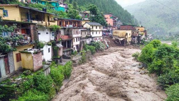
Uttarakhand govt studies past 100-year flood data to mark flood-prone areas
The study is being conducted by the district administrations of Rudraprayag and Chamoli, where flood protection measures will be taken in respective areas.
In a bid to protect the population living in the Alaknanda-Mandakini valley of Chamoli and Rudraprayag districts of Uttarakhand, the state government has now started a study of floods reported from these areas in the past hundred years.

The study is being conducted by the district administrations of Rudraprayag and Chamoli, where flood protection measures will be taken in respective areas by finding areas with maximum frequency of flooding. The study would cover Mandakini river’s stretch from Kedarnath to Rudraprayag and Alaknanda river’s stretch from Badrinath to Rishikesh.
Manuj Goyal, district magistrate of Rudraprayag, said that the study is being undertaken following the guidelines of Uttarakhand Flood Plain Zoning Act.
“Under the Act, demarcations are made based on flood level data ranging from 25-100 years. Officials from the irrigation department are studying the flood data from all past years and after the study, new demarcations will be made in flood-prone areas,” said Goyal.
Also read: Delhi-Jaipur highway partially opened amid farmers’ protest
He added that after the study is completed and the areas are notified as flood plains, zones will be identified where protective work can be done and areas where limited level of development work should be done. Due to periodic flooding in the rivers originating from the Himalayas, the population living on their banks have suffered a heavy loss of life and property.
“Many times, locals build houses in sensitive areas which later get affected due to natural calamities. Such kind of a study with demarcations will help us avoid disasters in the future and prevent losses incurred by locals,” added the district magistrate.
In Chamoli district, the district magistrate said that the work has almost been completed in Tharali and Chamoli blocks.
Swati Bhadouriya, district magistrate Chamoli said, “Identification of flood plain zones have been done in Tharali and Chamoli blocks. It is being done for the whole of the Alaknanda valley, with the aim of sustainable development for the future. After completing the study, the details will be sent to the state government for the next course of action.”


