
 E-Paper



Sutradhara’s tales: Geography begets history, and a river runs through it
No, it is not faulty city planning that we see in all this, it is the function of things that existed before the city, the geography and the landscape

 Prefer HTon Google


So, what does commuting in Pune look like to you? Stressful? Frustrating? But, beyond that have you ever noticed how many times one has crossed bridges?; how many times the vehicle suddenly ascends or descends a slope? How you are taken aback by sharp bends on roads, roads meeting at odd angles, round-about ways at arriving at a destination, or a sudden joyride on an occasional meander?
Why is there no grid pattern of horizontal and vertical roads to help us navigate easily?
No, it is not faulty city planning that we see in all this, it is the function of things that existed before the city, the geography and the landscape.
Pune is not a settlement planned in 20th century, like the city of Chandigarh, but has grown organically over atleast two millennia and has responded to the natural settings for most part of its life.
Folks, today we take a tour of Pune’s environs through the school geography text books.
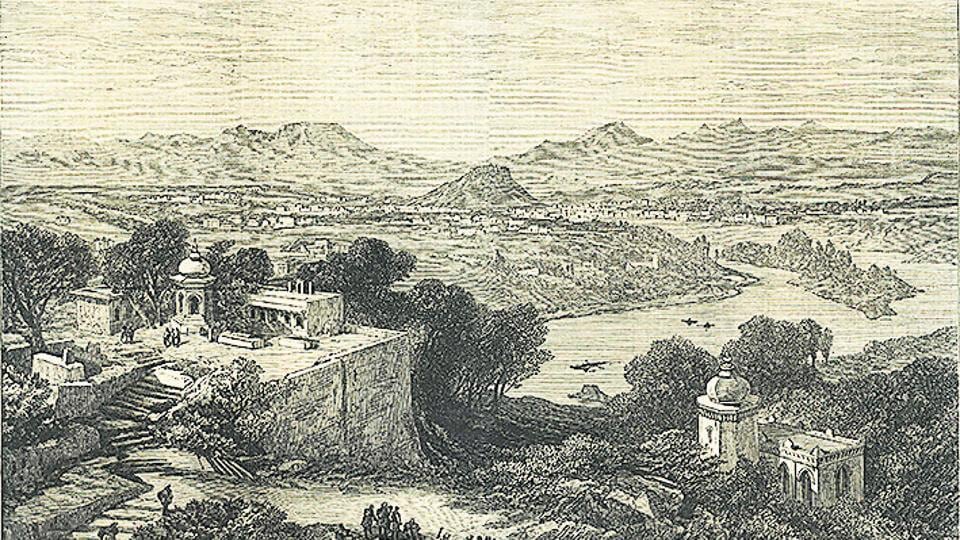
Pune is part of what we call western Maharashtra. It is settled on western slopes of the mighty Sahyadris - the Western Ghats running along a north-south parallel to India’s western coast.
Various west flowing rivers, originating in the Sahyadris have excavated the volcanic Deccan trap layers to form broad river valleys and leave behind moderate reliefs of secondary hill ranges, such as the Shambhu Mahadev range.
With Sahyadri in the backdrop, Pune is nestled in cosy valleys of the Shambhu Mahadev ranges sinking in the plains to the east.
In doing so, Pune forms a strategic connection and central space.
The continuous Katraj hills form the western southern boundaries where the Parvati-Taljai-Waghjai ranges enter the city centre from the south west.
The hills travelling from Sahyadri in the west form the connection via NDA, Mhatoba, Vetal, Chaturshringi and end with the Fergusson hills across the river Mutha.
The Range hills, Baner-Pashan hills occupy the north eastern corners. The east is relatively open with lone Yerawada and Dighi hills where the grasslands dominate.
Pune is located amicably at a height of 560 metres above sea level, blessed with ambient climate and three moderate seasons.
Climate is on hot arid side, but the physical settings make it more conducive and comfortable, the quintessential Pensioner’s Paradise!
The original source of water for Pune region, west flowing rivers and the streams is the Southwest Monsoon and it receives the decent annual rainfall of 722 mm.
The rainfall last for four months and further the seasonal rivers carry water for the next four months thus providing water for an average of eight to 10 months in a year (this was before dams, canals and wells!).
This is a decent average for seasonal rivers to support a settlement in harsh Deccan region.
So, how many rivers do you think flow through Pune?
Mula and Mutha are principal rivers which are known to average Punekar (some ignorant folks still confuse the Mutha and Mula.)
Like major river-based civilisations, Pune enjoys its settlement on the banks of river Mutha and Mula which are tributaries of the river Bhima meeting the larger river Krishna.
Even today, the epicentre of growth of Pune is located on banks of river Mutha from which the city grew to the present size.
The sacred confluence of important rivers, Mula and Mutha in Pune is marked at Sangam, near the present College of Engineering, not by any large pilgrim site, but the settlement of Pune itself.
It is roughly situated in a saucer shaped basin with two main rivers and hills on all sides. But, as we take stock of greater Pune, we can count six rivers, namely Mula Mutha, Pavana, Indrayani, Ram and the youngest and shortest Dev (originating near NDA hills), which flow through this city.
Till recently, the Ram and Dev were not acknowledged as rivers by the town planning authorities, but now thanks to historical evidence and vigilant citizens’ movements their status as rivers have been duly reclaimed. Various rivulets and streams which originate in the hills of Pune further divide the river basin to form distinct landforms.
Nagjhari stream, Ambil Odha, Bhairoba nala and such freshwater streams (once!) were revered as sacred water sources. They formed the physical boundary dividing cultural landscape of Pune in later days. River Mutha enters Pune it as it rolls down from the steeper Sahaydri slopes and hits the wider valleys which allow it to meander through. The meander invariably causes the excavation of and deposition on the alternate river banks. These eventual deposition processes create the safe grounds which stay above the seasonal flood lines of the river.
It also creates fertile agricultural lands ready for cultivation. Early settlers have favoured this arrangement and have taken refuge on the same as we shall see in our further conversations.
Politically, Pune is part of Western Maharashtra located in state of Maharashtra, but it is the physical features such as mountains, rivers, ridges and hill ranges that have determined its expanse in the past. These physical environmental features have allowed expansion or limit the spread in of the Human settlement of Pune and hence, have been acting as boundaries.
These physical landscapes and waterscapes continue to provide the amicable, life giving foundation to the life-scape and people-scape of Pune. So while we take great pride in calling ourselves most liveable city in India, we should not forget respecting the blessed land and definitely strive to protect, conserve the “Punya-Bhumi” of Pune.
Saili Palande-Datar is an indologist, environmentalist, history researcher and farmer. She can be reached @ sailikdatar@gmail.com


