
 E-Paper



Monsoon rain likely to be above normal in most of India, says IMD
The India Meteorological Department on Tuesday upgraded its monsoon forecast to 106% of the long period average (LPA) for the June-September season


The India Meteorological Department on Tuesday upgraded its monsoon forecast to 106% of the long period average (LPA) for the June-September season, citing the early onset and rapid progress of the southwest monsoon across the country.
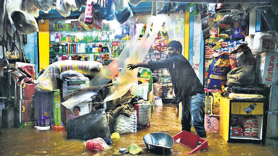
This represents an upward revision from IMD’s April forecast of 105% of LPA, with the model error margin tightened to ±4% from the earlier ±5%. The updated prediction reinforces expectations of above-normal rainfall across most of India, though IMD has warned that “above-normal rainfall carries benefits for agriculture and water resources but also introduces risks such as flooding, disruptions to transportation, public health concerns, and harm to ecosystems.”
For June specifically, a month that is typically hot and humid for most parts of India, the weather department expects above-normal rainfall averaging 108% of LPA across the country, with normal to above-normal monthly rainfall likely over most parts except some southern peninsular regions and parts of northwest and northeast India.
“We can say that monsoon is expected to be good over most parts of the country,” said M Mohapatra, director general of IMD, announcing the revised forecast on Tuesday.
The monsoon made onset over Kerala on May 24—eight days ahead of schedule—and has since shown remarkably rapid progress. Within two days of its Kerala arrival, the rains covered large parts of the country including Mumbai on the west coast and almost all of northeast and peninsular India, marking what officials described as a “classical onset.”
But, officials warned that this rapid progress may not continue indefinitely. “A low-pressure area has developed over Bay of Bengal which will also help monsoon progress but after 3-4 days monsoon progress may slowdown. A hiatus may be expected,” Mohapatra noted. This expected slowdown will be mainly due to mid-latitude dry air intrusions.
June is also likely to be marked by normal to below-normal day temperatures for most parts of the country, except many regions of northwest and northeast India where above-normal temperatures are expected. Above-normal nighttime temperatures are forecast across most areas, except some parts of central India and adjoining south peninsula.
While 2-3 heat wave days typically occur over northwest India in June, IMD predicts “below normal” or hardly any heat wave days this time. However, officials cautioned that “people need to be cautious about humid heat and high nighttime temperatures.”
Over the next four months, the seasonal rainfall is most likely to be above normal over central India and south peninsular India (>106% of LPA), normal over northwest India (92-108% of LPA), and below normal over northeast India (<94% of LPA). Rainfall over the monsoon core zone, consisting of most rainfed agriculture areas, is also likely to be above normal.
According to subdivision-wise forecast, 32 of India’s 36 meteorological subdivisions are expected to receive normal to above-normal rainfall, with only three northeastern regions —Arunachal Pradesh, Assam & Meghalaya, and Nagaland-Manipur-Mizoram-Tripura—forecast to receive below-normal precipitation.
Some northern regions including Saurashtra & Kutch, Punjab, and Haryana-Chandigarh-Delhi are forecast to receive exceptionally high rainfall exceeding 115% of their long-period averages.
The probability breakdown shows a 32% chance of “above normal” rain (105-110% of LPA), 27% probability of “excess” rain (>110% of LPA), 31% probability of “normal” rain (96-104% of LPA), 8% probability of “below normal” rain (90-95% of LPA), and only 2% probability of “deficient” rain (<90% of LPA).
“Monsoon made a classical onset and progressed very quickly over large areas in association with a monsoon vortex. A depression formed over Arabian Sea which helped its onset but all large scale and regional scale criteria for monsoon onset were also met,” Mohapatra explained.
The northern limit of monsoon as on Tuesday cut through Mumbai, Pune, Sholapur, Kalaburagi, Mahbubnagar, Kavali, Agartala, and Goalpara. Conditions were favourable for further advance into remaining parts of central Arabian Sea, more areas of Maharashtra, remaining parts of Karnataka, additional sections of Telangana and Andhra Pradesh, parts of Chhattisgarh and Odisha, most of west-central and more parts of north Bay of Bengal, remaining northeastern states, and parts of West Bengal and Sikkim over the next 2-3 days.
The favourable outlook is supported by neutral El Niño-Southern Oscillation (ENSO) conditions and neutral Indian Ocean Dipole patterns. Climate models indicate these neutral ENSO conditions will likely continue during the monsoon season, though a weak negative IOD may develop. Crucially, the hostile influence of El Niño is not expected this year.
The upgraded forecast holds significant implications for India’s agriculture-dependent economy. With 51% of the country’s farmed area relying entirely on rainfall and 47% of the population dependent on agriculture for livelihood, above-normal rainfall across the monsoon core zone could boost agricultural productivity and rural incomes.
Officials advised farmers to “follow agro-met advisories to suitably time harvest” as weather patterns evolve during the season.
The early monsoon progress comes amid unusual weather patterns, particularly the persistence of western disturbances over northwest India well into May. These systems, which typically bring winter rain and are most active during December-February, have remained active unusually late into the season.
“Yes, WDs are persisting till summer this year. Monsoon has not progressed to NW India yet and hence we cannot say whether it will interact with these WDs. One of the main reasons we are seeing sudden, intense thunderstorm activity over NW India is the unusual persistence of these WDs,” Mohapatra explained.
M. Ravichandran, secretary at the ministry of earth sciences, noted that “when the weather systems gradually move away, a slowing down is expected,” referring to the anticipated deceleration in monsoon progress after the initial rapid advance.



