Several parts of northwest India continue to receive widespread and heavy rain with thunderstorm and lightning.
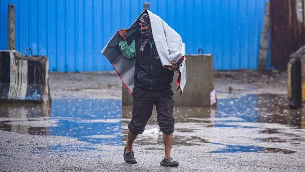
Moderately intense rain is likely to occur over Alwar, Tizara, Kotputli, Deeg, Bharatpur in Rajasthan; Aligarh, Jattari, Iglas, Khair, Sahaswan, Hathras, Barsana, Khurja, Anupshahar, Gabbana, Chandausi, Bhajoi, Sambhal in UP; Palwal, Hodal, Aurangabad, Nuh in Haryana during the next two hours according to India Meteorological Department.
Delhi recorded 39.9mm rain between 8.30am on Saturday and 2.30pm on Sunday — far higher than the 21.7mm average rain quota for all of January.
Also Read: 40mm rain in 36 hrs throws Delhi out of gear, more likely today: IMD
More rain, as well as hailstorm and thunderstorms are expected till Tuesday, according to IMD scientists.
An active western disturbance is lying as a middle and upper level cyclonic circulation over central Pakistan with its induced cyclonic circulation over southwest Rajasthan. A north-south zone of wind confluence is also observed from north Punjab to northeast Arabian Sea, with a strong interaction between southwesterly winds and lower level moist southeasterlies.
All these favourable meteorological features for rain are likely to persist till January 5 and continue to cause moderate to intense rain with thunderstorm, lightning and hailstorm at isolated places in northwest India till the night of January 5 with peak activity on January 3 and 4 over the plains (Punjab, Haryana, Chandigarh and Delhi, West Uttar Pradesh and north Rajasthan ) and on January 4 and 5 over the western Himalayan region (Jammu & Kashmir, Ladakh, Gilgit-Baltistan, Muzaffarabad, Himachal Pradesh and Uttarakhand).
{{/usCountry}}All these favourable meteorological features for rain are likely to persist till January 5 and continue to cause moderate to intense rain with thunderstorm, lightning and hailstorm at isolated places in northwest India till the night of January 5 with peak activity on January 3 and 4 over the plains (Punjab, Haryana, Chandigarh and Delhi, West Uttar Pradesh and north Rajasthan ) and on January 4 and 5 over the western Himalayan region (Jammu & Kashmir, Ladakh, Gilgit-Baltistan, Muzaffarabad, Himachal Pradesh and Uttarakhand).
{{/usCountry}}Northerly-northwesterly winds likely to set in over northwest India causing “cold” wave to “severe cold” wave conditions at isolated places over Punjab, Haryana and north Rajasthan from January 7.
“When there is an induced cyclonic circulation in association with a western disturbance, the system is very intense. Moisture is feeding in from the Arabian Sea, so we are seeing widespread snowfall in the hills and intense thundershowers in the plains. We are expecting hailstorm in some parts of the city on Monday and thundershowers on Tuesday. Once the western disturbance moves away, minimum temperatures are likely to fall again to 4 to 5 degrees Celsius but they may not fall as low as 1 or 2 degrees Celsius,” Kuldeep Shrivastava, head, regional weather forecasting centre, said on Sunday.