The Capital remained locked in a bubble of bad air for most of Monday, as a grey sheet tinted the city yet again and kept the air quality index (AQI) within touching distance of the “severe” zone, though steady surface winds and showers in the evening helped wash pollutants away to some extent.
Delhi recorded a 24-hour average AQI of 395 (very poor) at 4pm on Monday, just five points away from the severe category, according to the Central Pollution Control Board’s (CPCB) official bulletin. Though this reading was barely unchanged from 396 at the same time a day ago, it was a marginal improvement from 402 at 7am on Monday.
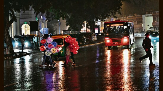
Still, a persistent breeze throughout the afternoon, and a sharp spell of rain in the evening helped ease pollution levels to some extent. At 8pm, for instance, Delhi’s hourly average AQI was 360. At 9pm, it improved to 351, then 341 at 10pm, and further to 340 at 11pm.
The 24-hour average was at 391 at 9pm, and eased marginally to 384.
According to the India Meteorological Department (IMD), the Capital received 7.2mm of rain till 8.30pm,accompanied by thunder and lightning, resulting in nine flights being diverted from the Indira Gandhi International Airport.
{{/usCountry}}According to the India Meteorological Department (IMD), the Capital received 7.2mm of rain till 8.30pm,accompanied by thunder and lightning, resulting in nine flights being diverted from the Indira Gandhi International Airport.
{{/usCountry}}This was Delhi’s first spell of rain since November 10, and the fortnight-long stranglehold of pollution has been unabated since November 12 (Diwali night).
While pollution during the first half of this polluted fortnight was exacerbated by Diwali fireworks and driven by noxious smoke from farm fires in Punjab, these have abated over the past week, with the kharif season wrapping up in the agrarian state. Punjab recorded no farm fires on Monday, data from the state government showed.
Delhi’s pollution has still remained either in the severe or near-severe (390+) zone for fiveof the past seven days, with residents of the city being force-fed lungfuls of poisonous air largely comprised of local emissions, the impact of which has been worsened by calm winds and dropping temperature.
As a consequence, this is likely to be Delhi’s most polluted November in at least eight years, according to CPCB data.
Till Monday, the Capital’s monthly average AQI (according to the official 4pm bulletins) was 377, the highest for November in the last eight years. The previous highest average AQI before this was 376 in November 2021.
Data shows Delhi has recorded nine “severe” air days so far this month, behind only November 2016 (10 severe days) and November 2021 (11). However, like Monday, Delhi has also recorded eight days when the AQI has been between 390 and 400 — on the brink of “severe”. So the city’s AQI has been 390 or worse on 17 of the 27 days so far this month. In comparison, November 2021 had the second-most such days at 13.
Monday showers, which may give Delhi’s residents some breathing space, came on account of a western disturbance that travelled over the Capital after bringing heavy rain to Gujarat and Rajasthan over the weekend. The rains were also accompanied by stronger transport winds, which blew in relatively warmer winds from the south-east.
Warmer air helps pollutants rise up and dissipate, as compared to colder air, which keeps pollutants locked in the lower reaches of the atmosphere.
In fact, according to IMD officials, winds speeds hit 50kmph in the city in the evening.
“As the western disturbance hit the city, we saw winds of around 20kmph at Palam and 12kmph at Safdarjung in the afternoon. This increased to around 50kmph by evening in some parts. Such gusty winds are usually seen during the monsoon season,” said Kuldeep Srivastava, scientist at India Meteorological Department (IMD).
The western disturbance also left the city slightly warmer on Monday. Delhi clocked a maximum temperature of 24.2°C on Monday, two degrees below normal, but the minimum temperature was 13.4°C, three above normal and also three degrees more than it was on Sunday.
These winds will likely leave the city with stronger air for at least a couple of days, added the agency.
“The air quality is likely to remain in the ‘very poor’ category from November 28 to 30. The predominant surface wind is likely to be coming from north-east direction with wind speed 4kmph, with partly cloudy sky and shallow fog in the morning on November 28. The wind direction may change to east by November 29 while it will be coming from variable directions on November 30,” said the CPCB’s AQI forecast.
According to IMD’s forecast, the minimum and maximum temperatures will be between 12°C and 25°C respectively for the next couple of days with shallow to moderate fog in the morning.