“Extremely severe cyclone” Fani, which made landfall in Odisha coast on Friday morning, appears catastrophic in terms of its intensity and the long span of sustenance but rescue teams are well-prepared to combat it, experts said.
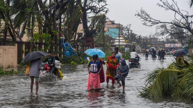
The cyclone is being seen as unique because of its trajectory, which will cover several districts of Odisha, three districts of Andhra Pradesh, several districts of West Bengal and parts of northeast India. Further up its route is Bangladesh, which has already started evacuation of 2.1 million people.
Though some experts said Fani was possibly the strongest cyclone since the 1999 Odisha Super Cyclone that killed about 10,000 people, M Mohapatra, the director general of meteorology (India Meteorological Department), said the cyclone was not as intense as Phailin, which, too, was an “extremely severe cyclonic storm” and struck in 2013. Mohapatra indicated that India’s forecasting system and the disaster relief mechanism have improved, saying, “We had much better coordination this time, managed to save lives.”
KJ Ramesh, the director general of meteorology, explained why Fani is different. It is unusual for a cyclone to impact so many places together in its route, he said. “This one is taking very long to weaken. It is catastrophic. The re-curvature characteristics of this cyclone are also something we didn’t see in the past.
{{/usCountry}}KJ Ramesh, the director general of meteorology, explained why Fani is different. It is unusual for a cyclone to impact so many places together in its route, he said. “This one is taking very long to weaken. It is catastrophic. The re-curvature characteristics of this cyclone are also something we didn’t see in the past.
{{/usCountry}}“Our models predicted very well...as predicted the cyclone re-curved towards Odisha on May 1. I think the only issue we failed to predict was the exact time of landfall,” he said.
Private forecaster Skymet said the super cyclone of 1999 struck Odisha with a wind speed of 225-250 kmph. “Fani struck with a wind speed of 205 kmph. It will now move to West Bengal as a severe cyclone,” said Mahesh Palawat, vice-president (meteorology and climate change) at Skymet Weather. “Ocean temperatures have been very warm feeding the intensity and life of Fani,” he added.
A note by Climate Trends, a Delhi-based communications strategy initiative which has collated information from NASA and other resources, said, “Water in the Bay of Bengal was unusually warm as Cyclone Fani was forming — by more than 1°C above the long-term average. higher sea-surface temperatures increased the energy available to the storm. Globally, ocean temperatures have increased dramatically as a result of climate change.