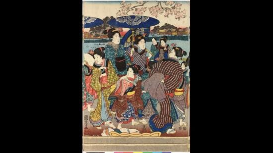
There’s a lot more to Japan’s famous sakura tradition than gathering to admire cherry blossoms.
This delicate annual rite is in fact a form of disaster-preparedness.
Every winter, moisture in the soil near riverbanks would freeze and expand. In centuries gone by, the spring thaw could then loosen the mud, and the slightest rain could trigger landslides.
So, way back in the 8th century, Nara rulers began to encourage spring picnics in April, a practice that spread from the nobility
There’s a lot more to Japan’s famous sakura tradition than gathering to admire cherry blossoms.
This delicate annual rite is in fact a form of disaster-preparedness.
Every winter, moisture in the soil near riverbanks would freeze and expand. In centuries gone by, the spring thaw could then loosen the mud, and the slightest rain could trigger landslides.
So, way back in the 8th century, Nara rulers began to encourage spring picnics in April, a practice that spread from the nobility to the general populace over time.
The weight of thousands of people walking about and sitting on blankets by the river helped compact the soil, “creating a man-made solidity, supporting the banks’ survival for another year,” says Miho Mazereeuw, an associate professor of architecture at the Massachusetts Institute of Technology (MIT), where she also set up and heads the Urban Risk Lab.
This unique culture is full of such workarounds, some of which Mazereeuw details in her book, Design Before Disaster: Japan’s Culture of Preparedness.
Simple examples include architecture that ensures that schools can double as emergency evacuation sites during earthquakes and floods. This means sturdier-than-normal construction, as well as more toilets, and reservoirs in the form of rooftop swimming pools “that also keep the school buildings cool in summer,” Mazereeuw says. Stairs are situated on the outsides of these buildings, so they can serve as an instant escape route during floods.
Japan, of course, has a long history of negotiating earthquakes and volcanoes, situated as it is above four tectonic plates. It has responded to this, Mazereeuw notes, by creating a collective culture of preparedness that the world at large could now benefit from. Hearing stories from her Japanese parents of how this culture routinely saved lives, and how seamlessly it was woven into daily life, inspired her interest in this field, she adds.
What are some of the most intriguing Japanese design-for-disaster lessons? Take a look.
* Waju: Inside the circle
In the Nobi Plain where the Kiso, Nagara and Ibi rivers intersect, severe flooding is common, as are sudden surges caused by snowmelt in the Japanese Alps.
So, centuries ago, local communities devised a system of massive waju or circular embankments that protected their homes, farms and granaries, while allowing the waters to flow all around them.
Through a complex network of sluice gates, they also managed to direct floodwaters and river water through these flat, low-flying but rich and fertile lands, to irrigate their fields.
Eighty-two such embankments once protected farms and hamlets across the Nobi Plain.
Homes within were built on stone platforms about 1.5 ft high. Storehouses for grain were built much higher, 8 metres or more above the ground. Villagers stored emergency supplies and even valuables here, and retreated to these structures when the waters rose too high.
The sluice gates here are still managed by local cooperatives.
One of the largest surviving such enclosures, Takasu Waju, was built in 1653 and still encircles homes, granaries and rice fields, all technically at sea level, across a sprawl of 4,260 hectares.
* Fire-resistant towns
Since 1981, Tokyo has had a series of bōsai or disaster-ready residential zones, focused on fire safety.
Here, firebreaks or non-combustible spaces such as roads, rivers and rail corridors are woven into the city’s grid system, to separate neighbourhoods in ways that would keep a large fire from spreading.
A major firebreak belt appears every 2 km. The grid curves with natural breaks such as rivers.
In addition, along narrower streets, where it would be easier for flying embers to spread, building codes specify that non-combustible material must make up at least 40% of all street-facing walls. That number can move upwards, to 60% and even 80%, as the lane narrows.
* Evacuation gardens
In 1923, amid the Great Kanto earthquake and the massive fire that followed, an estimated one million Tokyo residents survived because they escaped to open tracts of forest and farmland.
Public parks then provided camping space for hundreds of thousands of people who had lost their homes.
This forever changed how Japan viewed its parks. They became a key feature in emergency-response plans. In the post-earthquake reconstruction of Tokyo, statesman Shinpei Goto even introduced a plan for refuge parks that would be equipped to house thousands at a time. Tokyo is still building more.
Today, such spaces are fitted with solar-powered charging stations for electric bicycles and phones, public benches that can turn into cooking stoves, and manholes that double as emergency toilets. Perhaps the best-known of these is the Tokyo Rinkai disaster prevention park, a 33-acre space where lampposts serve as LAN connections too.
Tokyo alone has 58 such park-refuges.
What’s interesting, Mazereeuw points out, is that the government isn’t the only entity responsible for driving such efforts. Organisations such as the Japan Bosai group unite over 100 companies that provide technology, infrastructure and expertise ranging from river-monitoring sensors to seismic reports and automated floodgates.
There is a collective approach to Japanese disaster preparedness, because it is understood, Mazereeuw adds, that a truly successful disaster-management strategy requires government and people both.
One Subscription.
Get 360° coverage—from daily headlines
to 100 year archives.
Archives
HT App & Website