Gurugram’s air quality improved for the second consecutive day on Monday, with the city’s air quality index (AQI) falling to 247, its lowest in 14 days, aided by a change in wind direction and weather conditions.
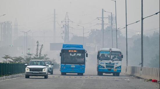
The city recorded an AQI of 296 on Sunday and 340 on Saturday, marking a 93-point improvement over two days, according to the Central Pollution Control Board’s (CPCB) daily 4pm bulletins.
Monday’s reading placed Gurugram in the ‘poor’ category after six consecutive days of ‘very poor’ air quality between November 9 and 14.
During this period, the AQI had climbed as high as 345 on November 9, before dropping below 300 on Sunday.
Despite the improvement, fine particulate matter (PM2.5) remained the dominant pollutant at all four monitoring stations in the city on Monday, according to the Hindustan Times pollution dashboard.
Gwal Pahari recorded the highest AQI at 283, followed by Teri Gram at 274, Vikas Sadan at 233 and Sector 51 at 196, according to CPCB’s Sameer app. All four monitoring stations were operational on Monday.
According to the Central Pollution Control Board’s (CPCB), an AQI between zero and 50 is considered ‘good’, 51 to 100 “satisfactory”, 101 to 200 ‘moderate’, 201 to 300 ‘poor’, 301 to 400 ‘very poor’, and 401 to 500 ‘severe’.
{{/usCountry}}According to the Central Pollution Control Board’s (CPCB), an AQI between zero and 50 is considered ‘good’, 51 to 100 “satisfactory”, 101 to 200 ‘moderate’, 201 to 300 ‘poor’, 301 to 400 ‘very poor’, and 401 to 500 ‘severe’.
{{/usCountry}}The improvement was also reflected in the air quality recorded across Haryana. According to CPCB’s 4pm bulletin, only two cities, Ballabhgarh and Hisar, were in the ‘very poor’ category, while 11 recorded ‘poor’ air quality. Seven cities were in the ‘moderate’ category and three in the ‘satisfactory’ category.
Weather officials attributed the improvement to a western disturbance that altered wind direction, helping disperse accumulated pollutants. However, they cautioned that the relief could be temporary, with dry weather expected to return.
“The marginal improvement in the air quality can be pegged to the western disturbance which changed the wind direction to south-westerly. However, the improvement is short-lived as the state is set to face dry weather in the next three to four days,” said a senior IMD official.
According to the India Meteorological Department’s (IMD) daily bulletin, Haryana is likely to experience dry weather over the next few days, with minimum temperatures expected to fall by around 2°C during the next three to four days. Dense fog is also likely at isolated places during the night and morning hours between November 17 and 20.
Gurugram also recorded a sharp fall in temperatures on Monday. The maximum temperature dropped by 3.7 degrees from Sunday to settle at 27.7°C, while the minimum fell by 3.8 degrees to 15.6°C, according to IMD Chandigarh’s 6pm bulletin.
The decline was in line with the trend across Haryana, where the average maximum temperature fell by 1.6 degrees and the average minimum by 3.1°C from Sunday. Both remained near normal levels.
Sirsa recorded the state’s highest maximum temperature at 29.1°C, while Panchkula was the coldest at 10.9°C.
Stay updated with all the Breaking News and Latest News from Mumbai. Click here for comprehensive coverage of top Cities including Bengaluru, Delhi, Hyderabad, and more across India along with Stay informed on the latest happenings in World News.
Stay updated with all the Breaking News and Latest News from Mumbai. Click here for comprehensive coverage of top Cities including Bengaluru, Delhi, Hyderabad, and more across India along with Stay informed on the latest happenings in World News.