The Lucknow Development Authority (LDA) has completed a detailed electronic total station (ETS) survey of the areas surrounding the property linked to the accused in the Saadatganj triple murder case to establish the extent of alleged unauthorised construction and encroachment on the premises.
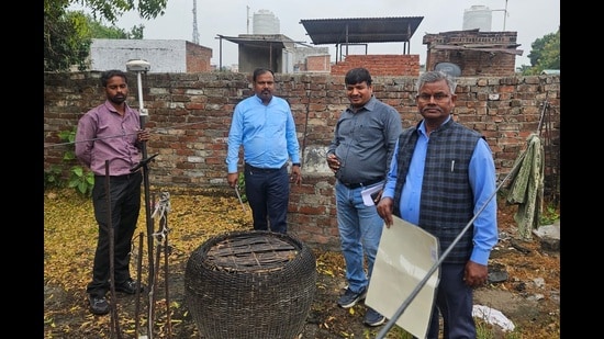
The survey, which began on Friday, aims to establish how the property has changed over the years by mapping its existing structures, vacant portions and other physical features. The LDA will compare these findings with available maps and records before deciding on any further action against the property owner.
A senior LDA official, speaking on condition of anonymity, confirmed that the survey had concluded. A private agency conducting the exercise is expected to finalise its report by Saturday evening and submit it to senior LDA officials for examination.
How the ETS survey will establish illegal construction
An LDA official revealed that unlike a routine physical inspection, the ETS survey uses specialised surveying equipment to record the precise measurements and geographical positions of structures and land features across an identified area.
The agency captures the existing layout, including buildings, boundaries, vacant land and other physical features. It then prepares a detailed map using the collected measurements and compares it with earlier maps and available land records.
{{/usCountry}}The agency captures the existing layout, including buildings, boundaries, vacant land and other physical features. It then prepares a detailed map using the collected measurements and compares it with earlier maps and available land records.
{{/usCountry}}This comparison will help the LDA identify whether owners have extended existing structures, occupied previously vacant portions or constructed buildings beyond the permissible boundaries.
The survey also assumes significance as the authority is undertaking such a detailed ETS exercise in the area after several years.
Officials will examine the private agency’s findings before deciding on enforcement action. The report is expected to provide a factual basis for determining which portions, if any, violate approved maps or involve encroachment.