NEW DELHI: Cyclone Asani formed over southeast Bay of Bengal on Sunday morning and it is likely to intensify into a severe cyclonic storm clocking wind speed of 89 to 117 kmph during the next 24 hours, India Meteorological Department (IMD) said.
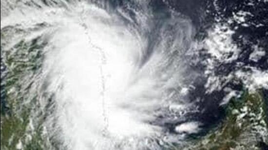
Landfall on the Indian coast is however unlikely according to IMD’s latest bulletin. The deep depression over Southeast Bay of Bengal moved west-northwestwards with a speed of 16 kmph during past 6 hours, intensified into a cyclonic storm ‘Asani’ and lay centered over Southeast Bay of Bengal about 450 km west-northwest of Car Nicobar (Nicobar Islands), 380 km west of Port Blair (Andaman Islands), 970 km southeast of Visakhapatnam (Andhra Pradesh) and 1030 km south-southeast of Puri (Odisha).
It is very likely to move northwestwards and intensify further into a Severe Cyclonic Storm over east central Bay of Bengal during next 24 hours. It is likely to continue to move northwestwards till May 10 evening and reach West central and adjoining Northwest Bay of Bengal off North Andhra Pradesh and Odisha coasts. Thereafter, it is very likely to recurve north-northeastwards and move towards Northwest Bay of Bengal off Odisha coast, IMD said.
Light to moderate rainfall is likely at a few places with heavy rainfall at isolated places over coastal Odisha and adjoining areas of north coastal Andhra Pradesh from May 10 evening. On May 11, heavy rainfall at isolated places is likely over coastal Odisha and adjoining coastal areas of north Andhra Pradesh and West Bengal.
{{/usCountry}}Light to moderate rainfall is likely at a few places with heavy rainfall at isolated places over coastal Odisha and adjoining areas of north coastal Andhra Pradesh from May 10 evening. On May 11, heavy rainfall at isolated places is likely over coastal Odisha and adjoining coastal areas of north Andhra Pradesh and West Bengal.
{{/usCountry}}On May 8, gale wind speed reaching 70-80 kmph gusting to 90 kmph is likely to prevail over southeast and adjoining east central Bay of Bengal and would gradually increase reaching 90- 100 kmph gusting to 110 kmph over the same region from May 8 evening. On May 9, gale wind speed reaching 105-115 kmph gusting to 125 kmph is likely to prevail over central parts of Bay of Bengal. On May 10, gale wind speed reaching 95-105 kmph gusting to 115 kmph is likely to prevail around the system centre over West central and adjoining Northwest Bay of Bengal. Squally wind speed reaching 40-50 kmph gusting to 60 kmph is likely along and off north Andhra Pradesh coast. Gale wind is likely to affect these regions on May 11 and 12 also.
On May 8, sea condition is very likely to become high to very high (9 to 14 m wave height) over southeast and adjoining Eastcentral Bay of Bengal. The sea condition over Andaman Sea would gradually improve becoming rough. On May 9, 10, 11 and 12 also sea condition is likely to be high to very high over west central Bay of Bengal.
Fishermen are advised not to venture into central parts of Bay of Bengal on May 9 and 10 and over Northwest Bay of Bengal from May 10 to 12. IMD has advised total suspension of fishing and tourism activities; avoid going to areas that face the water logging problems often; avoid staying in vulnerable structure and regulate off-shore activities in affected states.