The severe cold spell which northwest India experienced in the latter half of December (December 15 to 30) was unprecedented due to several reasons. One of them was its large area of impact. The maximum temperature in December was 17.5 degree C over northwest India, the lowest since 1971, according to an analysis by India Meteorological Department (IMD).
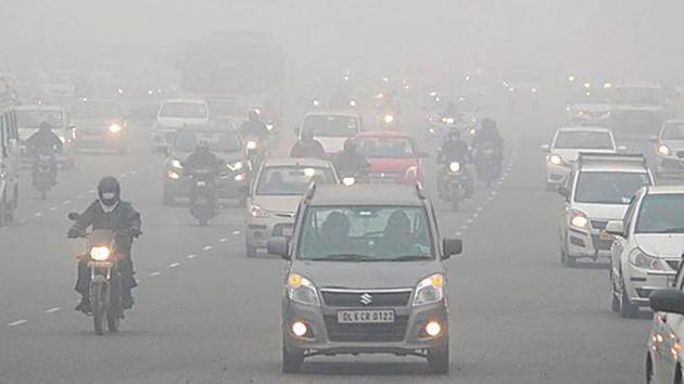
The average maximum temperature’s departure from normal for December was also the lowest since 1971 at - 3.2 degree C. Normal maximum temperature for December in northwest India is 20.7 degree C. This analysis has been made based on maximum temperature averages of Jammu and Kashmir, Himachal Pradesh, Punjab, Haryana, Delhi, Uttarakhand and Uttar Pradesh.
When spatial distribution was considered, south Punjab, northwest Rajasthan and west Haryana region recorded average maximum temperatures which were 6 degree C to 7 degree C below normal for the entire month.
The analysis states that cold day conditions were severe most on December 30 when the maximum temperature over the entire region was 15 degrees C below normal.
Though the analysis states that factors leading to such severe cold day conditions include a western disturbance (WD) which originated as a cyclonic circulation over North Atlantic Ocean and started affecting the northwestern region from December 11, the larger cause of a prolonged cold spell is still being studied by IMD.
The active WD and its interaction with lower level easterlies caused widespread rain and snow accompanied with hailstorms in some places on December 12 and 13. “This supplied abundant surface moisture to the plains of northwest India. After passage of this WD, strong lower level westerlies continued over the plains of north India for subsequent 15-16 days. Left entrance region of the Sub-Tropical Westerly Jet (STWJ) (westerly flow of winds in winter) also continued to be over the region of Punjab, Haryana, Chandigarh, Delhi, north Rajasthan and west Uttar Pradesh,” the analysis states.
{{/usCountry}}The active WD and its interaction with lower level easterlies caused widespread rain and snow accompanied with hailstorms in some places on December 12 and 13. “This supplied abundant surface moisture to the plains of northwest India. After passage of this WD, strong lower level westerlies continued over the plains of north India for subsequent 15-16 days. Left entrance region of the Sub-Tropical Westerly Jet (STWJ) (westerly flow of winds in winter) also continued to be over the region of Punjab, Haryana, Chandigarh, Delhi, north Rajasthan and west Uttar Pradesh,” the analysis states.
{{/usCountry}}This, along with consistent lower level clouds over north Indian plains, prevented short wave solar insolation (solar energy) from reaching the earth surface. Also, there were no lower level easterlies or no active WD affected the Indian region during December 15 and 30 which could disrupt the cold spell, the analysis said.
While these local features were discussed even during the cold spell, IMD scientists are now studying if there is any link of the episode with the Siberain High (an area of high pressure that forms over Siberia in winter.
“Our reading is that such a cold spell cannot be a result of local features alone. There have been western disturbances recently with similar extensive snowfall but such a drop in maximum temperatures over several days was not seen. We are trying to understand if the Siberian High or the Arctic Oscillation (climate pattern characterised by winds circulating counterclockwise around the Arctic ). But that will require more study. We know that many north Indian stations, including Delhi and Gwalior, made new records for maximum temperature in December,” said RK Jenamani, senior scientist at National Weather Forecasting Centre.
A fresh WD is likely to affect the Western Himalayan region and plains of northwest India from January 20 which is likely to cause scattered to widespread rain and snow over western Himalayan region on January 20 and 21. Dense to very dense fog is also likely in some parts of Punjab, Haryana, Chandigarh, Delhi, Uttar Pradesh and Bihar in the next two to three days.