The Indian Space Research Organsiation (Isro) on Friday night launched its navigation satellite NVS-03 from the Satish Dhawan Space Centre in Sriharikota, Andhra Pradesh.
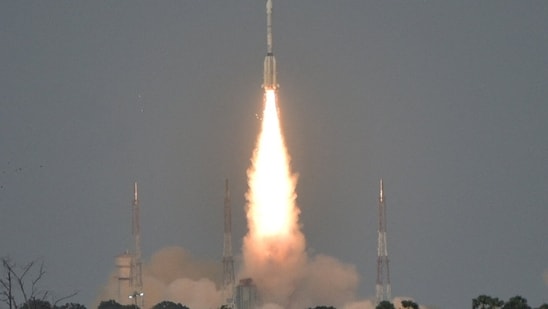
The satellite, which was abroad a GSLV-F18 rocket had lift off at 11:51pm IST on Friday from the second launch pad of the space centre in Sriharikota.
According to the mission brochure, the targeted orbit for the satellite has a planned perigee (closest point to Earth) of 170 km and an apogee (farthest point) of 37,023 km, at an inclination of 20.75 degrees.
Also Read | ISRO to launch NVS-03 satellite on October 30 to boost navigation for trains, vehicles and ships
What is NVS-03?
NVS-03 is the third, second-generation navigation satellite designed to maintain and boost the continuity of the Navigation with Indian Constellation (NavIC) system. With this satellite, the GSLV rocket marks its 20t flight.
"Navigation with Indian Constellation (NavIC) is India’s independent regional navigation satellite system designed to provide accurate Position, Navigation and Timing (PNT) service to users in India as well as the region extending about 1500 km beyond the Indian landmass, which is its primary service area," said Isro in its brief about the mission.
The space organization added that the satellite will carry an indigenous atomic clock, along with the procured atomic clocks.
{{/usCountry}}The space organization added that the satellite will carry an indigenous atomic clock, along with the procured atomic clocks.
{{/usCountry}}"It will also include a L1 signal in addition to existing L5/S signals with coverage over India land mass and a region extending 1500 km around Indian geopolitical boundary," the statement added further.
India's launch of NVS-03 comes as it works towards its own navigation system, which will reduce dependence on the Global Positioning System (GPS), which is currently owned by the US government.
Furthermore, the atomic clocks on these satellites give the time as well, which is crucial for banks, stock exchanges and the armed forces, who rely on precise time, and small differences between time sources can affect their operations.
This comes after the government announced in 2025 that it would stop using GPS to keep Indian Standard Time and switch to five atomic clocks in Guwahati, Bengaluru, Ahmedabad, Faridabad and Bhubaneswar.