...
...
Next Story

Weather Bee | Uttarakhand's forest fires are now spreading to higher reaches

Uttarakhand is facing a significant increase in forest fires, with data showing fires spreading to higher elevations, posing new challenges for containment.

Published on: May 9, 2024, 08:40:15 IST
Advertisement

Since last week, active fires in Uttarakhand have multiplied. On May 5 and May 6, more than 1,000 active fires were recorded in the state by satellites, the highest so far this season. This spurt in fires in the past week has also been accompanied by another trend: fires in the state are now being recorded at higher elevations. The maximum elevation where satellites detected active fires in Uttarakhand in the first week of April was 2,409 metres above sea
PREMIUMForest fires are not unusual in Uttarakhand, or, for that matter, in any jungle. (PTI)
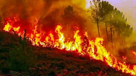
Forest fires are not unusual in Uttarakhand, or, for that matter, in any jungle. (PTI)
Uttarakhand fires

To find whether there is a trend in the elevation of Uttarakhand fires, HT grouped daily active fires by week. In the first week of April, the state recorded 781 active fires at a median (the middle value in an ascending or descending series) elevation of 1,288 metres. This median height decreased to 1,157 metres in the week ending April 14 but has increased in every week since. In the week ending May 5, the median height of the 4,933 active fires in the state was 1,481 metres.

To be sure, the median value highlights that the entire spread of fires in the state has shifted higher. While this median elevation has increased by only 193 metres, the highest elevation of fires has shifted by a much bigger degree. In the week ending April 7, the maximum recorded elevation of active fires was 2,409 metres. In the week ending May 5, the maximum recorded elevation of an active fire was 3,383 metres, a rise of almost a kilometre upwards.

A possible reason for the fire spreading to higher reaches could be the natural progress of the stubble-clearing season in the state to higher reaches. The state government imposed a week-long ban on stubble and waste burning on May 5.

As reported previously in this column, a large number of active fires recorded in March and April is a regular phenomenon in Uttarakhand, with drier-than-usual weather possibly contributing to the bigger spike in fires this year. With the Uttarakhand government alleging that arsonists were involved in igniting the fires, it is important to understand the pressure of man-made factors on the natural environment already burdened with an expanding and rapidly urbanising population. For example, stubble burning in Uttarakhand may not be as big an issue as in Punjab or Haryana, but ending it in the state has the same limitations as in Punjab or Haryana: lack of cheap alternate measures for quick stubble clearing. To be sure, dry pine needles are also burnt by residents of the upper reaches of the state to clear their fields. Since these needles are also decomposed to biomass after collection, bigger incentives for such collection can also help control fires in the state in the long run.

Chart:

Abhishek Jha, HT’s senior data journalist, analyses one big weather trend in the context of the ongoing climate crisis every week, using weather data from ground and satellite observations spanning decades.

Since last week, active fires in Uttarakhand have multiplied. On May 5 and May 6, more than 1,000 active fires were recorded in the state by satellites, the highest so far this season. This spurt in fires in the past week has also been accompanied by another trend: fires in the state are now being recorded at higher elevations. The maximum elevation where satellites detected active fires in Uttarakhand in the first week of April was 2,409 metres above sea level. The maximum elevation of active fires had increased to 3,383 in the week ending May 5, a rise of almost a kilometre.

PREMIUMForest fires are not unusual in Uttarakhand, or, for that matter, in any jungle. (PTI)
Forest fires are not unusual in Uttarakhand, or, for that matter, in any jungle. (PTI)

To find whether forest fires are spreading to higher elevations in Uttarakhand, HT used two data sources. The location of fires was derived from the Visible Infrared Imaging Radiometer Suite (VIIRS) of the Suomi NPP satellite (operated by the US National Oceanic and Atmospheric Administration), which reports the coordinates where active fires are detected in the two passes the satellite makes over India in a day. To be sure, the instrument only detects if an area with a resolution of 375 meters per pixel has any active fires. The elevation of these coordinates was found from the terrain elevation data of the Shuttle Radar Topography Mission (SRTM). Analysis of these two datasets together shows that as active fires have increased in Uttarakhand, they have also spread to higher elevations.

Uttarakhand fires

To find whether there is a trend in the elevation of Uttarakhand fires, HT grouped daily active fires by week. In the first week of April, the state recorded 781 active fires at a median (the middle value in an ascending or descending series) elevation of 1,288 metres. This median height decreased to 1,157 metres in the week ending April 14 but has increased in every week since. In the week ending May 5, the median height of the 4,933 active fires in the state was 1,481 metres.

To be sure, the median value highlights that the entire spread of fires in the state has shifted higher. While this median elevation has increased by only 193 metres, the highest elevation of fires has shifted by a much bigger degree. In the week ending April 7, the maximum recorded elevation of active fires was 2,409 metres. In the week ending May 5, the maximum recorded elevation of an active fire was 3,383 metres, a rise of almost a kilometre upwards.

A possible reason for the fire spreading to higher reaches could be the natural progress of the stubble-clearing season in the state to higher reaches. The state government imposed a week-long ban on stubble and waste burning on May 5.

As reported previously in this column, a large number of active fires recorded in March and April is a regular phenomenon in Uttarakhand, with drier-than-usual weather possibly contributing to the bigger spike in fires this year. With the Uttarakhand government alleging that arsonists were involved in igniting the fires, it is important to understand the pressure of man-made factors on the natural environment already burdened with an expanding and rapidly urbanising population. For example, stubble burning in Uttarakhand may not be as big an issue as in Punjab or Haryana, but ending it in the state has the same limitations as in Punjab or Haryana: lack of cheap alternate measures for quick stubble clearing. To be sure, dry pine needles are also burnt by residents of the upper reaches of the state to clear their fields. Since these needles are also decomposed to biomass after collection, bigger incentives for such collection can also help control fires in the state in the long run.

Chart:

Abhishek Jha, HT’s senior data journalist, analyses one big weather trend in the context of the ongoing climate crisis every week, using weather data from ground and satellite observations spanning decades.

All Access.
One Subscription.

Get 360° coverage—from daily headlines
to 100 year archives.

E-Paper
Full
Archives
Full Access to
HT App & Website
Games
 
ABOUT THE AUTHOR
Abhishek Jha

Abhishek Jha is Assistant Editor-Data at Hindustan Times. He uses statistical programming to generate newsworthy insights from large datasets. He is part of the team that produces Number Theory, a daily data story feature of the paper’s print edition. Since March 2024, he has been writing Weather Bee, a weekly column for the Hindustan Times website. He is a chemical engineer by training, who specialises in stories related to weather, climate, and the environment. Jha has been at HT since 2018, where he offers data-driven perspective and analysis on politics, environment, weather, climate, economy and society. His work includes data coverage of elections in India and abroad, including the 2019 and 2024 Lok Sabha elections; the disasters and extreme weather resulting from changing climate, such as floods, droughts, heat waves, cold waves, and dwindling snow cap in the Himalayas; the factors that drive poor air quality in northern India; the changing patterns of land use; the Covid-19 pandemic and its impact on labour market conditions; the changing pattern of consumer spending seen in the new consumer spending surveys; and social norms seen in the surveys such as the National Family Health Survey.

SHARE THIS ARTICLE ON
Hindustantimes wants to start sending you push notifications. Click allow to subscribe