The Punjab and Haryana high court has directed Centre and Haryana to procure three -dimensional satellite imagery of Charkhi Dadri area to ascertain environmental damage due to mining in Aravalis.
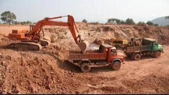
The high court bench of acting chief justice Ashwani Kumar Mishra and justice Rohit Kapoor observed that the matter is of serious concern not only for the revenue of the state but also on account of the damage caused to the environment. “We would, therefore, expect a more prompt and effective response from the concerned respondents,” the bench added.
It was hearing a petition from some villagers and a local stone crusher owner, from Pichopa Kalan village in Charkhi Dadri with allegations that state authorities have allowed indiscriminate illegal mining by private respondents on their plots as well as on adjoining areas far beyond the approved mining site, causing prejudice not only to the petitioners but to the residents and farmers of the village and thereby causing severe damage to the ecological balance in the area. Subsequently, serious allegations were levelled against a private firm, which got license in 2016 alleging that they have not got royalty from the firm and the firm mined area far more than allotted to it.
In December 2025, a lawyer was appointed as court commissioner by the court, which came out with a damning report. The report said, integrity of the mining block boundary is compromised. The terrain was found to be unstable and posed serious safety concerns. The court had then termed the case that of a “plunder and loot”.
{{/usCountry}}In December 2025, a lawyer was appointed as court commissioner by the court, which came out with a damning report. The report said, integrity of the mining block boundary is compromised. The terrain was found to be unstable and posed serious safety concerns. The court had then termed the case that of a “plunder and loot”.
{{/usCountry}}On July 15, high court had directed that Centre to explore the possibility of putting in place a standard operating procedure (SOP) to ensure that 3-D satellite imagery, along with its geo-coordinates, is preserved from the time a site is put to mining purposes at fixed intervals, such as every six months or one year. “Such imagery should be placed in the public domain for the perusal of the public at large so that any aggrieved person may raise a valid grievance and, in the event of failure on the part of the authorities, the court can take appropriate action,” the court had said adding that once such an SOP is put in place, the authorities would be better equipped to protect environmental interests. Similar response was sought from the state authorities also and 3-D imagery of the area in question was sought.
However, when the case was taken up on August 6, the court found that the previous order passed had not been complied with by the parties.
Now, it has sought 3-D satellite imagery again and asked Centre and Haryana to comply with the order by August 27. “The affidavit in terms of the above observations shall be filed at least 48 hours before the next date of hearing,” it ordered also impleading the Ministry of mines as necessary party in the case.