E-Paper



U.P’s forest cover up by 559 sq km, 2nd highest growth in country
U.P. is followed by Odisha that saw 558.57 sq km increase in its forest and tree cover. Rajasthan (394.46 sq km) and Jharkhand (286.96 sq km) are next in order

 Prefer HTon Google


Uttar Pradesh ranked second among states where the forest and tree cover have gone up, as per India State of Forest Report (ISFR)-2023 released by Union minister for environment, forest and climate change Bhupender Yadav in Dehradun on Saturday.
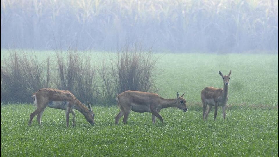
U.P. recorded an increase in forest and tree cover by 559.19 sq km or 1,38,179 acres, which is 0.23% of the total geographical area of the state or more than the Indore city area. First on the list is Chattisgarh (683.62 sq km). This was the 18th such report and is published once every two years.
U.P. is followed by Odisha with 558.57 sq km increase in its forest and tree cover. Rajasthan (394.46 sq km) and Jharkhand (286.96 sq km) are next in order.
Acknowledging the state’s achievement, chief minister Yogi Adityanath said on X: “New Uttar Pradesh is moving fast to become Green Uttar Pradesh. According to ISFR-2023, Uttar Pradesh recorded a historic rise of 559 sq km forest and tree cover, which is result of Prime Minister Narendra Modi’s call of ‘Ek Ped Maa Ke Naam’ and the association of people with the “earth is our mother and we are her children” spirit. Congratulations to all the people associated with the plantation drive.”
U.P’s forest cover reached 15,045.80 sq km (6.24%), an increase of 118.43 sq km from 14,927.37 sq km (6.20%) recorded in ISFR-2021 report. The tree cover of the state was recorded at 8,950.92 sq km (3.72%) in the 2023 report while it was at 8,510.16 sq km (3.53%) in the 2021 report. The total green cover reached 23,996.72 sq km (9.96%) against 23,437.53 sq km (9.73%) in the 2021 report.
Among U.P. districts, Jhansi saw the highest rise in green cover (8,597 acre) followed by Amroha (7,769 acre). Sonbhadra, one of the eight aspirational districts, is leading the tally of districts for the highest green cover. It has 2,407.87 sq km of the total forest area.
In the recent report, the green cover was measured to be 9.96% (2,40,928 sq km) of the total geographical area of the state, which was 9.23% earlier.
Forest minister Arun Saxena credited the CM for the rise in green cover. “It was the chief minister’s vision and innovative methods to include common people to plant and save saplings that made this a success. In the years to come, we will see even better results,” said the forest minister.
U.P’s jump in its green cover is being attributed to a mega plantation drive under which the state planted 168 crore saplings in the past seven years. “In the past seven years, the state planted over 210 crore saplings and action was ensured against defaulters and criminals that paved the way for the state’s green cover to reach 9.96% of the total geographical area,” said PP Singh, a senior Indian Forest Service (IFS) officer.
According to the report, U.P. registered a rise in green cover in all segments, including reserved forest areas (RFAs) and outside RFAs. Very dense forest (VDF) inside RFAs in 2021 was recorded at 2,504.56 sq km while in the 2023 report, this figure was 2,537.81 sq km. The total figure of forest cover, including VDF, moderately dense forest (MDF) and outside forest (OF), for 2021 was 9,299.60 sq km while in the 2023 report, it measured 15,045.80 sq km.
Out of the total 15,045.80 sq km of forest cover, VDF was 2,688.73, MDF 4,001.41 sq km, OF 8,355.66 sq km, which is 6.24% of the total geographical area of the state. The scrub area was recorded at 639.51 sq km, which is 0.27% of the geographical area.
The state’s total forest cover, including green cover, rose to 23,996.72 sq km (9.96%) from 23,437.53 sq km stated in the 2021 report.
It may be noted that Very Dense Forest (VDF) means all lands with tree canopy density of 70% and above. Moderately Dense Forest (MDF) are all lands with tree canopy density of 40% and more but less than 70% while Open Forest signifies lands with tree canopy density of 10% and more but less than 40%. A scrub is a forest land with canopy density less than 10%.
Sonbhadra leads in total forest area
Sonbhadra, one of the eight aspirational districts in Uttar Pradesh, leads the district tally of total forest cover. It has 2,407.87 sq km of total forest area.
After Sonbhadra is Kheri district with 1,234.13 sq km of forest area. MIrzapur (736.91 sq km), Pilibhit (673.84 sq km), Chitrakoot (636.56 sq km), Bahraich (531.41 sq km), Balrampur (555.65 sq km), Saharanpur (525.00 sq km) are next in order.
According to the report, a total of 54 districts, including Lucknow, do not have any very dense forest (VDF). According to India State of Forest Report–2023 (ISFR-2023), Varanasi, Unnao, Sitapur, Siddharthnagar, Shamli, Sant Kabir Nagar, Sambhal, Saharanpur, Rae Bareilly, Pratapgarh, Muzaffarnagar, Moradabad, Meerut, Mau, Mathura, Mainpuri, Mahoba, Lucknow, Lalitpur, Kaushambi, Kasganj, Kanpur, Kanpur Dehat, Kannauj, Jhansi, Jaunpur, Jalaun, Hathras, Hapur, Hardoi, Hamirpur, Gazipur, GB Nagar, Ghaziabad, Agra, Aligarh, and Amroha, also do not have VDF.
Mau has 11.37 sq km of forest while Varanasi has a total of 16.49 sq km of forest area.