Expert teams tasked with surveying Saraswati Tal in Chamoli and Kedartal in Uttarkashi were flagged off on Tuesday as part of Uttarakhand’s efforts to reduce risks from glacial lakes and to strengthen disaster preparedness.
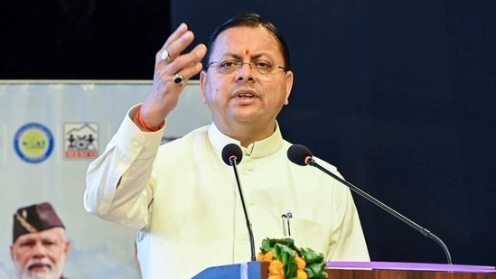
Disaster Management and Rehabilitation Secretary Vinod Kumar Suman flagged off the teams from the Uttarakhand State Disaster Management Authority (USDMA). Chief Minister Pushkar Singh Dhami and Disaster Management and Rehabilitation Minister Madan Kaushik wished the teams success.
Dhami said sensitive glacial lakes across the state are being subjected to scientific surveys and studies. The assessments will examine their current condition, water levels, changes in size, surrounding terrain and potential risk areas.
He said timely warnings to vulnerable areas are crucial in case of danger. Modern sensors, water-level measuring equipment, communication systems and other technical resources will be provided for timely action during a disaster.
Kaushik said protective and risk-reduction measures are being undertaken to minimise the impact of glacial-lake disasters. Vulnerable areas will be identified, while evacuation routes, possible impact zones, communication arrangements, local warning systems and rescue preparedness will be strengthened.
Suman said 13 glacial lakes in Uttarakhand have been identified as sensitive. Four have already been surveyed, while the remaining lakes are being studied in phases. The present teams will conduct bathymetric surveys of Saraswati Tal and Kedartal, examining their current condition, water levels, risk factors and possible downstream impacts.
{{/usCountry}}Suman said 13 glacial lakes in Uttarakhand have been identified as sensitive. Four have already been surveyed, while the remaining lakes are being studied in phases. The present teams will conduct bathymetric surveys of Saraswati Tal and Kedartal, examining their current condition, water levels, risk factors and possible downstream impacts.
{{/usCountry}}Saraswati Tal is situated at around 5,700 metres and Kedartal at about 4,750 metres. Experts from USDMA, ULMCC, BSIP Lucknow, Wadia Institute of Himalayan Geology, NIH Roorkee, SDRF, NDRF and Nehru Institute of Mountaineering are part of the joint survey teams. The initiative underscores the importance of scientific monitoring and preparedness, particularly high-altitude regions vulnerable to sudden changes and downstream impacts.