New Delhi: Severe cyclone Dana's landfall that commenced around midnight on Thursday continued to enter land until early morning of Friday. Even at morning around 6 am, Dana maintained the intensity of a severe cyclone with wind speed of 100-110 kmph gusting to 120 kmph.
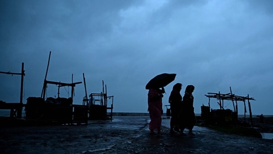
"The landfall process continues and the rear sector of the cyclone is entering land. The landfall process would continue for next 1-2 hours," IMD said in its bulletin.
"It is likely to move nearly west northwestwards across Odisha and weaken gradually into a cyclonic storm by forenoon..." IMD added.
The weather system over the Bay of Bengal is under continuous surveillance of the Doppler Weather Radar at coastal city, Paradip.
The size of the system is around 370 km, officials said, adding that on Thursday afternoon, it was traversing warm waters over northwest Bay of Bengal. The sea surface temperature was around 30 degrees Celsius over central and north Bay of Bengal. There are chances that Dana’s intensity may increase further, marginally before landfall, officials said.
Read more: Cyclone Dana makes landfall in Odisha; trees uprooted amid severe storm, rain. All eyes on impact: 10 updates
“The fact that severe cyclone Dana had a shorter travel time over sea may have helped prevent intensification to extreme category. The cyclone developed very close to the coast and hence its life is short. Yet, it’s a severe cyclone. It has increased intensity mainly because warm SST (sea surface temperature),” a senior IMD official said on Thursday. “Over north Bay of Bengal, the temperatures are higher even at depth so that helps the system intensify. Dry air from land will also help counter the intensity of Dana when landfall begins," he added.
{{/usCountry}}“The fact that severe cyclone Dana had a shorter travel time over sea may have helped prevent intensification to extreme category. The cyclone developed very close to the coast and hence its life is short. Yet, it’s a severe cyclone. It has increased intensity mainly because warm SST (sea surface temperature),” a senior IMD official said on Thursday. “Over north Bay of Bengal, the temperatures are higher even at depth so that helps the system intensify. Dry air from land will also help counter the intensity of Dana when landfall begins," he added.
{{/usCountry}}The official further said that there are two large rivers — Baitarini and Brahmani — near the landfall zone. “There is a large delta area so landfall process may take relatively longer,” the official added.
“Enhanced poleward outflow is seen in mid latitude westerlies, high SST, poleward outflow, moderate wind shear would support further intensification of the system. Most of the models are indicating further intensification of cyclonic storm into severe cyclonic storm over northwest Bay of Bengal,” the tropical cyclone advisory by the Regional Specialised Meteorological Centre had said on Thursday.