Days after Andhra Pradesh was battered by Cyclone Arnab, high speed winds are expected to hit the coastal state by November 3 after the India Meteorological Department (IMD) said on Saturday that a low pressure area in the Bay of Bengal was intensifying and is likely turn into a cyclone by November 2.
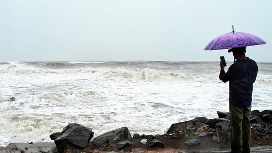
It is likely to make landfall on the Andhra Pradesh coastline in the early hours of November 3, IMD’s director general Mrutyunjay Mohapatra said, adding that winds of 80-90 km/hr – gusting up to 100 km/hr are likely.
If the latest storm fully develops into a cyclone, it will be called Murasu, meaning ‘drum’ in Tamil, a name proposed by India.
Deep Dive
Where and when was Cyclone Murasu expected to make landfall?
How strong were Cyclone Murasu’s forecast winds at landfall?
Which areas were forecast to receive heavy rain from Cyclone Murasu?
Also Read | ISRO timelapse video captures Cyclone Arnab's movement towards Andhra coast
Mohapatra, during a virtual press conference, also said a below normal rainfall and above normal temperatures are likely across most parts of the country in November. October 2026 meanwhile was the hottest ever since 1901, in terms of the average maximum temperature in the country.
“At present, we expect this to form into a cyclonic storm. Once formed, it will be named as Murasu. There is a slight possibility it may turn into a severe cyclonic storm too, but at present, our forecast is for a cyclonic storm, which should hit the Andhra coastline on the morning of November 3,” Mohapatra said.
{{/usCountry}}“At present, we expect this to form into a cyclonic storm. Once formed, it will be named as Murasu. There is a slight possibility it may turn into a severe cyclonic storm too, but at present, our forecast is for a cyclonic storm, which should hit the Andhra coastline on the morning of November 3,” Mohapatra said.
{{/usCountry}}Winds of up to 90 km/hr are classified by the IMD as a cyclonic storm. Between 90-120 km/hr is a ‘severe cyclonic storm’, between 120-165 km/hr is a ‘very severe cyclonic’ storm, 165-220 km/hr is an extremely severe cyclonic storm and over 220 km/hr is a ‘super cyclone’.
In its national bulletin, the IMD said at 5:30 pm, the depression over the southeast Bay of Bengal and adjoining areas of the Andaman and Nicobar Islands and the Andaman Sea moved west-northwestwards at a speed of 30 kmph over the past six hours. As of 5.30 pm on October 31, it was centred over the southeast Bay of Bengal, around 960 km east-southeast of Chennai, 980 km southeast of Visakhapatnam, 1,030 km southeast of Machilipatnam and 1,080 km east-southeast of Ongole in Andhra Pradesh.
Also Read | As Cyclone Arnab loses steam, second system intensifies into low-pressure area over Bay of Bengal
The system is likely to move west-northwestwards and intensify into a deep depression over the southeast Bay of Bengal by midnight on October 31. It is expected to further strengthen into a cyclonic storm on November 1 and a severe cyclonic storm over the west-central Bay of Bengal by November 2.
The cyclone is forecast to bring isolated spells of extremely heavy rainfall over Coastal Andhra Pradesh and Yanam November 2, with very heavy rainfall expected on November 3 as well.
“Isolated very heavy rainfall is also likely over Rayalaseema on both these days,” the IMD said.