
 E-Paper



Monsoon arrives in Kerala 7 days behind schedule: IMD
Climate scientists and meteorologists warned that it is expected to be a weak onset due to the severe Cyclone Biparjoy

 Prefer HTon Google


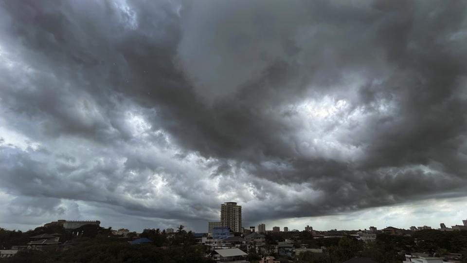
The monsoon arrived in Kerala on Thursday, seven days after it normally arrives in the state on June 1, the India Meteorological Department (IMD) said even as climate scientists and meteorologists warned that it is expected to be a weak onset due to the severe Cyclone Biparjoy. The progress of the weather system that brings rain across the country is likely to be slow in its first week.
“During [the past] 24 hours, clouding has increased over Southeast Arabian sea with Outgoing Longwave Radiation (OLR) being <200 w/m2. The depth of westerlies over [the] Southeast Arabian Sea extends up to mid-tropospheric levels. The strength of Westerlies in the lower levels has increased by about 19 knots. Thus, there has been widespread rainfall over Kerala during [the] past 24 hours. Considering...the... conditions, Southwest Monsoon has set in over Kerala...,” the IMD said in a statement.
The IMD added conditions were favourable for further advance of the monsoon into some more parts of the central Arabian Sea, Tamil Nadu, Karnataka, and southwest, central, northeast Bay of Bengal, northeastern states, and remaining parts of Kerala during the next 48 hours.
Climate experts and meteorologists earlier cited the formation of Cyclone Biparjoy over the southeast Arabian Sea and pointed out that it pulled all the convection along its track leading to the weakening of monsoon flow. The monsoon flow was expected to resume properly once the cyclone dissipated.
Skymet Weather vice president (climate and meteorology) Mahesh Palawat on Wednesday said there was some rainfall in parts of Kerala due to the cyclone that pushed some moisture towards the west coast since it is a very large system. He added that westerly winds were expected to pick up over the next two to three days. Clouding. was likely to increase as the cyclone moved northwards and picked up moisture from around it.
Palawat asked farmers to consider commencing the sowing after a week or 10 days in view of weak onset. “Once rains pick up sowing can begin so that crop is not affected. June rains may be below normal due to delay in rains,” Palawat said.
Rains were expected to pick up over northeast India in view of a low-pressure area developing over the Bay of Bengal, which will help pull monsoon winds to northeast India.
Indian Institute of Tropical Meteorology climate scientist Roxy Mathew Koll on Wednesday said since Cyclone Biparjoy was away from the coast, it was taking up a large share of the moisture. Koll added the monsoon rains may not be widespread at least for the current week. “It is not a classical monsoon onset. The rains we are seeing over Kerala is the monsoon picking up the leftover moisture from the cyclone.”
Last year, IMD declared the onset even though all criteria were not met.
The monsoon normally arrives in Kerala around June 1 before advancing northwards and covering the entire country by July 15. IMD on May 16 said the monsoon was likely to arrive in Kerala on June 4 with a model error of +/-4 days.
The monsoon is critical for India’s economy as 51% of India’s farmed area accounting for 40% of production is rain-fed. As many as 47% of the country’s population is dependent on agriculture for livelihood. A bountiful monsoon is directly linked to a healthy rural economy.
HT on June 1 reported the monsoon progress was likely to be dampened after its expected arrival in Kerala around June 4 with a model error of +/-4 days due to the chances of the development of a low-pressure area over the Arabian Sea around two days later. Officials then said the model outputs remained highly variable.
Experts say a delayed onset has little effect on monsoon rains.
IMD has forecast a “normal” monsoon at 96% with an error margin +/-5%) of the long-period average (LPA) of 87 cm calculated from 1971 to 2020. Private forecaster Skymet Weather has said “below normal” rainfall was expected at 94% of LPA with an error margin of +/-5%.
IMD follows a well-laid-out process of identifying onset parameters before announcing monsoon arrival. The first thing that is considered is rainfall. The two other criteria are a cross-equatorial flow of winds or a westerly flow at both lower and higher levels and whether there is adequate clouding over the region.
There is a nearly 100% probability of El Nino conditions during monsoon. It is expected to continue until next year, IMD said last month. El Nino is characterised by an unusual warming of waters in the eastern equatorial Pacific Ocean, which has a high correlation with warmer summers, drought, and weaker monsoon rains in India.
The 2023 El Nino is expected to develop following a triple dip La Nina event (2020-22). La Nina is the opposite of El Nino and is characterised by cooler currents in the equatorial eastern Pacific.



