The India Meteorological Department (IMD) said that northwest India is expected to witness light to moderate rainfall and a gradual rise in temperatures in the coming week.
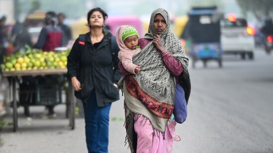
The weather department has further issued an orange alert for Punjab and Haryana, forecasting cold day conditions for the next two days, with maximum temperatures likely to fall 4.5 degrees Celsius below normal.
IMD scientist Naresh told ANI, "Cold day conditions are expected over Punjab and Haryana for today and tomorrow. However, no severe cold wave conditions are anticipated."
Rain is also predicted for Delhi-NCR and other parts of northwest India starting January 4, signaling the onset of a wet spell in the region. "From January 4 onwards, light to moderate rainfall is expected over the plains, including Punjab, Haryana, and Delhi-NCR," Naresh added.
IMD scientist Naresh said, “At present, there is a western disturbance over North Pakistan. It is likely to affect the Western Himalayas in the next two to three days and cause light to moderate snowfall.”
A stronger western disturbance is expected to impact the plains of northwest India, including Punjab, Haryana, Delhi-NCR, and Jammu and Kashmir starting January 4. The IMD official said, “We are expecting an active western disturbance from January 4, which may cause heavy snowfall over Jammu and Kashmir and light to moderate snowfall in Himachal Pradesh and Uttarakhand.”
Temperatures are expected to remain steady over the next 24 hours but are likely to rise by 2-4 degrees Celsius in the plains of northwest India thereafter.
{{/usCountry}}Temperatures are expected to remain steady over the next 24 hours but are likely to rise by 2-4 degrees Celsius in the plains of northwest India thereafter.
{{/usCountry}}In Uttar Pradesh, the maximum temperature dropped by more than 5 degrees Celsius in at least 50 districts, according to the Met office in Lucknow. Intense cold conditions are expected to persist until Wednesday, with the minimum temperature recorded at 13 degrees Celsius.
In Punjab, Bathinda recorded the lowest temperature at 5 degrees Celsius. Sangrur had a cold night at 5.3 degrees Celsius, while Faridkot saw a low of 6 degrees.
In Uttarakhand, many tourists flocked to scenic locations to enjoy the clear weather and bright sunshine following a period of heavy snowfall to welcome the New Year.
In the east, Jharkhand is expected to experience a significant temperature drop, with mercury dipping by 3 to 5 degrees in the next two days, according to the Met office. As the state prepares for the New Year, cold conditions are expected to continue, with dense fog in some areas.
Snowfall conditions in J&K
Coldwave conditions intensified across Kashmir on Tuesday, with the Met office predicting fresh spells of light to moderate snowfall throughout the week. Light snowfall is expected on New Year's Day, followed by another moderate snowfall later in the week.
According to the Met Office, Gulmarg, a popular tourist destination in north Kashmir, recorded a low of minus 11.5 degrees Celsius.
Pahalgam, the base camp for the annual Amarnath Yatra in south Kashmir, saw a minimum temperature of minus 8.4 degrees Celsius.
In Srinagar, temperatures dropped to minus 3.5 degrees Celsius, while Qazigund, the gateway town to Kashmir, recorded a minimum of minus 7.5 degrees. In south Kashmir, Kokernag had a low of minus 5.6 degrees Celsius.
(With inputs from ANI, PTI)