Guatemala has issued a nationwide alert, the country's second-highest emergency alert, after the eruption of Volcano Fuego. According to the National Institute of Seismology, Volcanology, Meteorology and Hydrology (INSIVUMEH) of the country, the eruption began on Monday, August 3, and is now entering an intense phase.
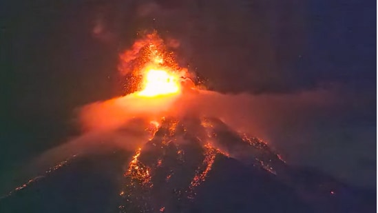
In view of the ongoing eruption of Fuego, Conred, Guatemala's disaster management authority, has issued evacuation notices and emergency directives, and has activated an "orange alert."
"An orange (danger) alert has been declared nationwide due to the eruption of the Fuego volcano," said the disaster coordination agency on X.
The agency has started evacuating two villages near the volcano, located 35 kilometres (22 miles) from the capital, Guatemala City.
{{/usCountry}}The agency has started evacuating two villages near the volcano, located 35 kilometres (22 miles) from the capital, Guatemala City.
{{/usCountry}}The government has also suspended local school activities and closed a road linking the south of the country to the colonial city of Antigua, a UNESCO World Heritage Site.
Fuego eruption to increase
As per the latest notice issued by INSIVUMEH, the eruptive pulse was Fuego recorded at 10:30pm local time, confirming that the eruption is set to increase and become more explosive in nature.
“A 200 to 300-meter lava fountain has developed. high above the crater, which throws material towards the upper part of all the ravines, causing the detachment of incandescent blocks that reach the edge of the vegetation,” reads the latest bulletin.
INSIVUMEH has also warned that the eruptive column of Volcano Fuego could exceed 7,000 metres above sea level, increasing the amount of ash in the atmosphere.
The volcanic institute has advised communities within a 10-kilometre radius of the volcano to evacuate immediately.
“The greatest threat is the pyroclastic density currents in different ravines of the volcano, so it is recommended to activate response plans in the municipalities located on the western and southern flanks of the volcano, especially those in the vicinity of the Seca and Ceniza ravines,” wrote INSIVUMEH.
Pyroclastic flows include fast-moving, deadly mixtures of hot gas, ash, and rock that race down a volcano's slopes during an eruption.
“Fuego Volcano continues to show an increase in its activity, generating pyroclastic density currents (pyroclastic flows) toward the Seca and Ceniza ravines on the Southwest flank of the volcano,” said a similar statement from Conred.
About Volcano Fuego
Volcano Fuego is one of Central America's most active volcanoes. Fuego is also one of three large stratovolcanoes overlooking Guatemala's former capital, Antigua, as per the Smithsonian Institution.
The institution adds that Fuego’s eruptions have become more mafic over time, a geological term for dark rocks and minerals that contain a lot of magnesium and iron but very little silica.