Hurricane Erin is currently a massive Category 4 storm swirling in the Atlantic after bursting in intensity at a record-breaking rate this past weekend.
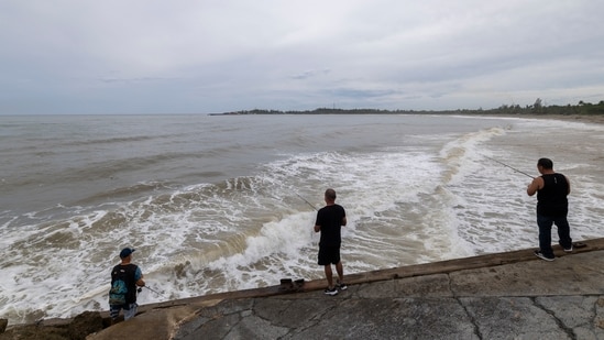
The main concern is storm's devastating effect with the potential to send dangerous rip currents and enormous waves toward the eastern US coastline and Bermuda.
Although the storm is expected to remain well offshore, as it gets set to move north, its vast wind field is already causing massive seas to travel hundreds of miles outward, bringing hazardous rip currents to US coasts, according to CNN.
Erin's impact in Puerto Rico
The National Hurricane Center (NHC) reports that Erin's outer rainfall bands began affecting the southeast Bahamas and the Turks and Caicos Islands early Monday and have tormented Puerto Rico, causing catastrophic flooding and power disruptions.
Beginning Tuesday, huge waves from the hurricane are predicted to hit parts of the East Coast and Bermuda, and conditions are predicted to get worse through the middle of the week.
“Even though Erin is expected to remain far offshore, the threat to life from rip currents and high surf along our beaches is very real,” the National Weather Service (NWS) office in Morehead City, North Carolina, cautioned in a beach hazards bulletin.
{{/usCountry}}“Even though Erin is expected to remain far offshore, the threat to life from rip currents and high surf along our beaches is very real,” the National Weather Service (NWS) office in Morehead City, North Carolina, cautioned in a beach hazards bulletin.
{{/usCountry}}Also Read: Mega tsunami could hit US Pacific Coast if Cascadia earthquake strikes, scientists say
Erin's potentially fatal effects
Over the next few days, Erin is expected to continue to linger offshore but become stronger and larger as it swings northeast between the US East Coast and Bermuda. This implies that its effects will be felt through the ocean rather than on land, including big, roaring waves, hazardous currents, and coastal flooding during high tides.
North Carolina's Dare County, which is home to the Outer Banks, declared a local state of emergency on Sunday, requiring Hatteras Island residents to evacuate.
“Coastal flooding and ocean overwash are expected to begin as early as Tuesday, August 19, 2025 and continue through Thursday, August 21, 2025. Portions of N.C. Highway 12 on Hatteras Island will likely be impassable for several days,” as per a news release.
Erin is also expected to have an impact on Bermuda, where forecasts predict extremely choppy seas and probably tropical storm-force winds later this week.