On the world map found in today’s classrooms, Greenland and Africa look about the same size. In reality, Greenland covers 2.16 million sq km. Africa covers 30.3 million, nearly 14 times as much. Even India, at 3.29 million sq km, is bigger than Greenland but the maps we see today suggest otherwise.
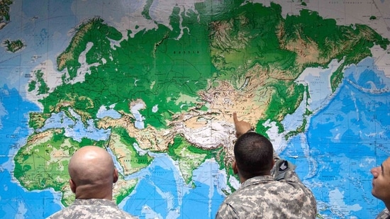
On Friday, the United Nations General Assembly voted 164 to one to encourage governments, schools, publishers and technology companies to stop using it. Togo moved the resolution, titled 'Correct the Map', on behalf of the 54-member African Group, with the Bahamas as co-sponsor and the African Union behind it. Estonia, Georgia, Lithuania, Moldova, Serbia and Ukraine abstained. The US cast the single vote against, calling the initiative a radical ideological project and a distraction from questions of peace and prosperity.
India voted in favour and then filed a qualification. Raghoo Puri, first secretary at India's permanent mission to the UN, told the assembly that the text should be read as support for equal-area projections in general "and not as endorsing the Equal Earth projection or any other specific map projection".
The resolution is not binding. It does not redraw borders and leaves Mercator's map in place for shipping and aviation.
{{/usCountry}}The resolution is not binding. It does not redraw borders and leaves Mercator's map in place for shipping and aviation.
{{/usCountry}}What the assembly voted for
The text, numbered A/80/L.104, records that a projection built in the 16th century for navigation is still the default in classrooms, newsrooms, digital platforms and official material, and that its distortions shrink the perceived size of Africa, Latin America and South Asia.
Instead, it now encourages states, schools, international organisations and technology companies, to use equal-area projections, Equal Earth among them, wherever relative size matters, and to teach students that every flat map distorts something. The resolution describes the correction as an act of "cognitive justice and memorial reparation".
The campaign behind it has been running for more than a year, driven by the advocacy groups Africa No Filter and Speak Up Africa. The African Union adopted Equal Earth in March, Togo carried the case to UN members in April on the Union's behalf, and the assembly held informal consultations on a draft in July.
Why the distortion happens
The fundamental issue is of dimensions and the question of how to represent lines across the planet on a piece of paper (or screen). Carl Friedrich Gauss proved in the 1820s that a sphere cannot be flattened onto a plane without stretching, tearing or squeezing it somewhere, so every projection is a choice about which error to accept. Mercator chose to preserve angles, so that on his map a constant compass bearing is a straight line. That made the projection indispensable at sea, and also made it the reason that the same map ended up on classroom walls.
The error falls on area, and it grows with distance from the equator, so land near the poles swells while land near the tropics does not. India is caught at the compressed end. At 3.29 million sq km it is half again as large as Greenland, and on a Mercator wall map Greenland looks several times bigger. The resolution records the same effect across Africa, Latin America and South Asia.
Also Read: Lake Ontario is now 'Lake America' on Google Maps in US
What Equal Earth does
Bojan Šavrič, Tom Patterson and Bernhard Jenny published Equal Earth in 2018, borrowing the rounded, globe-like look of the older Robinson projection while holding area constant everywhere on the map. Nasa's Goddard Institute for Space Studies used it that July for a global temperature map. Patterson wrote after Friday's vote that the three of them had never imagined this when they built it.
Equal-area maps preserve size at the expense of shape. Landmasses towards the edges and the poles come out visibly skewed, and no straight line on the map yields a compass bearing. Mark Monmonier, professor emeritus of geography at Syracuse University, has said Mercator is obsolete as a world map and that geographers have been advising against its use for years.
Why India qualified its ‘yes’
Puri said the resolution should stay technologically and methodologically neutral, and that countries, institutions and cartographers should keep the freedom to pick the projection that suits the task. India's support, he said, extends to equal-area approaches where the object is to preserve the relative sizes of continental landmasses.
India runs a substantial geospatial and satellite services industry whose products select projections for accuracy of distance, angle or area depending on the application. A UN text that named one map as correct would cut across that.
India's map regime is built around boundaries. The Survey of India controls the official depiction of the country's borders under the National Map Policy of 2005, and publishing a map that shows India's external boundaries incorrectly is a cognisable offence under the Criminal Law Amendment Act, 1961. Foreign atlases imported into the country are stamped with a note disowning their borders.
What UN vote will have impact on
To be sure, no authority governs how the world's maps are drawn, so Friday’s resolution's reach depends on who chooses to act on it.
France's foreign ministry said on Friday it would abandon Mercator for representations closer to true surface areas. Google moved its desktop map to a 3D globe at low zoom in 2018, though the mobile app still opens on Web Mercator, the variant that web maps use because it slices neatly into square tiles and keeps angles true at street level.
Boston's public schools switched to the Gall-Peters equal-area projection in 2017 and ran into resistance from parents and cartographers, some of whom objected to the elongated shapes it produces. Togo's campaign is aimed at textbooks, newsroom graphics and platform defaults, on the reasoning that mental images of the world form early and are hard to shift later. Whether any of those change now depends on education boards, publishers and technology companies, none of them represented in the General Assembly.