New Delhi: Dense fog and low clouds over the Himalayan foothills and the entire Gangetic plains till the Bay of Bengal that has persisted for a week to Tuesday is because of high moisture content in the upper atmosphere and lack of strong western disturbances, compounded by heavy particulate pollution and cold day temperatures, meteorologists said.
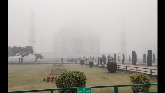
There has been an unusually low number of active western disturbances this winter, which is also resulting in extremely dry conditions over upper reaches of western Himalayas that are normally covered by snow during this time of the year, they said.
The movement of active western disturbances has shifted north, giving the Indian landmass a miss so far this winter, officials said. However, mild western disturbances that leave moisture behind are continuing to impact the region. On Tuesday, Delhi, Gurugram, Faridabad, Chandigarh, Bhiwadi, Bahadurgarh, Ghaziabad and Greater Noida, among others, also recorded very poor air quality, according to Central Pollution Control Board data.
“At the surface, winds are calm. But at higher levels, the winds are strong. There is very high rainfall deficiency over north India because western disturbances have moved north. When they are passing, some moisture remains. Due to clear skies earlier, there was surface cooling. Together, a fog has developed and has stayed,” said M Mohpatra, director general of the India Meteorological Department.
There is a 95% rainfall deficiency over northwest India in January, the weather office reported.
{{/usCountry}}There is a 95% rainfall deficiency over northwest India in January, the weather office reported.
{{/usCountry}}“We are seeing typical inversion conditions, where temperature near the ground is low, and a few metres upward, temperatures are higher. So air is not able to escape that level. There is light wind and moisture along the Himalayas,” said DS Pai, senior scientist at the weather bureau. “Unless this is broken by incursion of dry or strong winds, fog and smog will remain.”
“There have been a few mild western disturbances that have brought moisture to this region. Whenever humidity increases, there is overnight cooling and there are light winds, dense fog conditions develop. An active western disturbance can disrupt this cycle but that has not happened this winter at all,” said Mahesh Palawat, vice-president of climate and meteorology at Skymet Weather Services, a private forecaster.
“It is also clear that the fog has high particulate pollution,” he added. “We can expect similar conditions to persist for the next 4-5 days.”
Minimum temperatures remained in the range of 2-5 degrees Celsius over most parts of Punjab, Haryana, Chandigarh and Delhi; and in the range of 6-10 degrees over many parts of Uttar Pradesh, Rajasthan, north Madhya Pradesh, Bihar, Uttar Pradesh and Jharkhand. These are below normal by 1 to 4 degrees over many parts of northwest and east India. The lowest minimum temperature of 1.1 degree was reported at Hissar in Haryana on Tuesday.
Cold wave to severe cold wave conditions prevailed over many parts of Punjab, Haryana,Chandigarh and Delhi; in isolated pockets of West Uttar Pradesh, north Rajasthan and east Uttar Pradesh. Dense fog was reported over most parts of Punjab; in many parts of Haryana, Chandigarh and Delhi; in some parts of Uttar Pradesh; in isolated pockets of Uttarakhand, east Rajasthan and Bihar; and dense Fog in isolated pockets of Jammu, northwest Rajasthan, Assam, Meghalaya, Tripura, Odisha and Saurashtra, the Met office said.
The plains of northern India are experiencing jet stream winds of 140-150 knots, which would likely cause light rain and snowfall at isolated places over Jammu, Kashmir, Ladakh, Himachal Pradesh and Uttarakhand on January 17, it predicted. Light to moderate rainfall are expected in some places over Bihar, Jharkhand, Chhattisgarh, Odisha, West Bengal, Sikkim and northeast India from January 16 to 18, the weather office said.
Dense fog is likely to continue to prevail over northern India over the next five days. Severe cold day conditions are likely to continue over northern plains in the next two days and reduce thereafter, the Met office said.