Many parts of central and northwest India, particularly east Rajasthan, have seen extremely heavy rain in the last 24 hours, which, scientists at the India Meteorological Department (IMD) predict will last for the next two or three days. However, apart from bringing relief to the parched region, the heavy monsoon showers have also caused flooding and damage to roads at a few places.
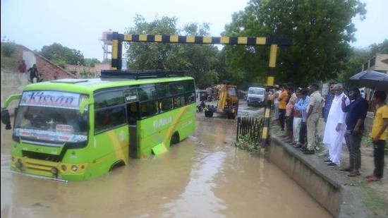
IMD scientists said Saiwad in Jaipur district recorded exceptionally high rainfall of 30cm between Saturday and Sunday. Makrana in Nagaur followed closely behind with 24cm rainfall and Hurda in Bhilwara with 22cm. Other places that also received significant rainfall were North Lakhimpur in Assam with 17cm; Rewa in Madhya Pradesh, Danta Ramgarh and Bhinai in Rajasthan with 15cm each; Pali, Jaitram and Ajmer in Rajasthan with 14cm each; and the Delhi Ridge with 14cm.
Between June 1 and July 31, northwest India recorded 2% rain deficiency but Haryana, Chandigarh and the Delhi region recorded 50% excess rain, with Delhi and Haryana recording 43% and 51% excess rain, respectively. “As predicted, east Rajasthan and west Madhya Pradesh are recording extremely heavy rain that is likely to continue for the next 2-3 days. Parts of northwest India will also get good rain. Saiwad in Jaipur district has possibly made a historical record with 30cm rain in 24 hours. There is a low-pressure area south of Delhi that is likely to become less marked while another low-pressure area is likely to move towards east Rajasthan across north Madhya Pradesh. That will bring very heavy rain to Rajasthan and Madhya Pradesh,” said RK Jenamani, senior scientist, national weather forecasting centre, IMD.
Rain distribution has been skewed in June and July. Northeast India has a rain deficiency of 13% with Arunachal Pradesh recording a 37% deficiency. Assam and Meghalaya have 24% deficiency while Nagaland, Manipur, Mizoram and Tripura have recorded 35% deficiency. Gujarat and the Kutch region have recorded 32% and 36% deficiency, respectively, while Kerala and Lakshadweep have recorded 28% and 49% shortfall. Overall, the country has recorded a 1% rain deficiency.
{{/usCountry}}Rain distribution has been skewed in June and July. Northeast India has a rain deficiency of 13% with Arunachal Pradesh recording a 37% deficiency. Assam and Meghalaya have 24% deficiency while Nagaland, Manipur, Mizoram and Tripura have recorded 35% deficiency. Gujarat and the Kutch region have recorded 32% and 36% deficiency, respectively, while Kerala and Lakshadweep have recorded 28% and 49% shortfall. Overall, the country has recorded a 1% rain deficiency.
{{/usCountry}}Parts of the country can look forward to more rain in the days to come. A well-marked low-pressure area is lying over southeast Uttar Pradesh and its neighbourhood. It is likely to move westwards to east Rajasthan across north Madhya Pradesh and adjoining southwest Uttar Pradesh during the next two days. A low-pressure area is also lying over the southern parts of Haryana and its neighbourhood. It is likely to become less marked during the next 24 hours.
IMD is expecting normal to above-normal rain over many parts in August due to La Nina conditions, a global meteorological phenomenon that brings about harsh winters and above-normal monsoon in India. O P Sreejith, head, climate monitoring and prediction group at IMD, said that in the past 50 years, there has been a trend of reduced rain in August, but this year could buck that trend due to the cooling of Pacific waters.