Monsoon rains in July haven’t been as bountiful as they were in June mainly because of the monsoon trough (line of low pressure) moving towards the Himalayan foothills repeatedly, leaving many parts of northwest and central India dry this month, according to data from the India Meteorological Department.
Until July 22, northwest India has a deficiency of -16% and northeast India has a surplus of 16%, contrary to what was predicted in June. IMD, in its long range forecast issued on June 1 forecast that northwest India is expected to receive excess monsoon rain at 107% of the long period average; Central India is likely to get 103% of LPA while south peninsula and northeast India area likely to receive 102% and 96% of LPA respectively with a model error of 8% (+/-).
IMD scientists said these trends could change over the next few months, adding that the main reason for this deviation is an unusually calm Bay of Bengal.
At least four to six low pressure systems form over the Bay of Bengal in the monsoon months, bringing rain over the core monsoon region—mainly central India.
“There has been no low-pressure systems over Bay of Bengal since June 21. There has been only one low pressure system this monsoon until now. Low pressure systems during the monsoon pull all moisture leaving the north-eastern region dry. These systems then bring a lot of rain along the core monsoon zone,” said DS Pai, senior scientist, IMD Pune. “The western Pacific is also unusually calm, there have been no typhoons there. This could be due to year on year variability.”
{{/usCountry}}“There has been no low-pressure systems over Bay of Bengal since June 21. There has been only one low pressure system this monsoon until now. Low pressure systems during the monsoon pull all moisture leaving the north-eastern region dry. These systems then bring a lot of rain along the core monsoon zone,” said DS Pai, senior scientist, IMD Pune. “The western Pacific is also unusually calm, there have been no typhoons there. This could be due to year on year variability.”
{{/usCountry}}“Low pressure systems are the main rain producing systems during the monsoon. Their formation depends on monsoon dynamics such as interaction of south-westerly and easterly winds,” added RK Jenamani, senior scientist, national weather forecasting centre.
“We haven’t seen any low-pressure system forming possibly because the Bay of Bengal is not as warm. These low-pressure systems move along the monsoon trough bringing rain in east, central, northwest India. Between July 27 and 29 there is likely to be a major confluence of south westerly and easterly winds which can bring a lot of rain in the Indo-Gangetic Plains from UP to the northeast accentuating floods once again in Bihar and northeast,” said Mahesh Palawat, vice president, Skymet Weather.
The Centre will soon release Rs 346 crore as an initial amount for handling the flood situation in Assam, an official statement by the central government said.
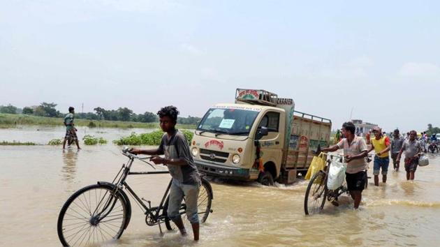
Followed by a discharge of around 3.50 lakh cusecs of water from the Valmikinagar barrage in Nepal, water from an aggravated Gandak river early on Wednesday morning inundated low-lying areas of Bagaha, Gopalganj and Vaishali in Bihar.