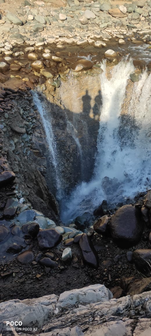
Srinagar: Tracer studies by a team of National Institute of Technology (NIT) in Srinagar has revealed that a sinkhole, which developed in Anantnag’s Brengi stream at Kokernag on February 11, has its discharge 16 kilometres downstream at Achabal.
Brengi stream is a tributary of Jhelum river.
“90% of the water going into the sinkhole has an outlet in Achabal, which is 16 km from the sinkhole,” Kokernag sub-divisional magistrate (SDM) Sarib Sehran said after a meeting of the National Disaster Management Authority (NDMA) on Wednesday.
Anantnag deputy commissioner Piyush Singla had confirmed the development earlier this week. “Tracer studies by NIT Sgr observed-‘Sinkhole has an outlet at Achabal at a distance of 16 km from sinkhole. There could be other outlets in nearby areas,” he tweeted on April 4.
“Interesting inference from an interesting phenomenon,” he added.
Sinkholes are pits in the ground that form in areas where water gathers without external drainage, according to the US Geological Survey.
The sinkhole at Wandeval village in Anantnag had dried out Jhelum’s Brengi tributary downstream for many kilometers, killing thousands of indigenous fishes along the stretch.
{{/usCountry}}The sinkhole at Wandeval village in Anantnag had dried out Jhelum’s Brengi tributary downstream for many kilometers, killing thousands of indigenous fishes along the stretch.
{{/usCountry}}Although district authorities had initially tried to divert the water from the sinkhole, the seepage had developed again, prompting the administration to seek assistance from NIT Srinagar to understand the phenomenon.
“Based on the preliminary study and tracer studies conducted by a six-member team from NIT Srinagar, it was inferred that the phenomenon occurred due to underlying karst topography,” Sehran said.
“The district administration has filled the sinkhole with naturally graded material and crates,” he added.
Besides NIT Srinagar, a multi-departmental team, including representatives from Kashmir University, geology department, fisheries, jal shakti and revenue departments is also conducting a study on the matter, the SDM said.
“Preliminary studies were conducted and the decision to fill the sinkhole was taken after due deliberation with all stakeholders,” a government spokesperson said, seeking anonymity.
Ghulam Jeelani, professor and head of department of earth and environmental sciences at University of Kashmir, had earlier told HT that a sinkhole is an expression of an underground network of caves. “Anantnag, as the name suggests, means numerous springs and their discharge often is high in Achabal, Andarnag, Martand and Verinag. It means there is a lot of storage inside in the form of caves which take millions of years to form,” he said.
“South Kashmir requires mapping of this underground cavern system. Today, it happened in the stream; tomorrow it can happen in the built up area. It can be done using foreign collaboration by conducting cave diving and geophysical surveys,” he said.