China has established an underwater surveillance network which will help its navy track target vessels more accurately and give it a cutting edge in the Indian Ocean and the South China Sea, reports on Monday said.
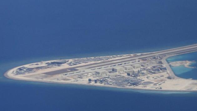
Experts believe the technology will “tip the scales in China’s favour” in the disputed South China Sea and the Indian Ocean, where India currently “holds sway”.
According to the Hong Kong-based South China Morning Post, the system collects information about the underwater environment, particularly water temperature and salinity, which the navy can then use to more accurately track target vessels as well as improve navigation and positioning.
China is flexing its muscles in the world’s seas by claiming the world’s busiest sea routes and establishing foreign naval bases.
Although the Chinese navy is still no match for the US, its forays in the world’s sea routes and growing assertiveness has worried Washington, Tokyo, Canberra and New Delhi.
“The project, led by the South China Sea Institute of Oceanology under the Chinese Academy of Sciences (CAS), is part of an unprecedented military expansion fuelled by Beijing’s desire to challenge the United States in the world’s oceans,” the Post report said.
Yu Yongqiang, a member of the expert panel overseeing China’s global underwater surveillance network, said Beijing has to deal with unfriendly littoral states in the South China Sea while it faces India, which is tightening its grip over the Indian Ocean due to China’s growing presence in the region.
{{/usCountry}}Yu Yongqiang, a member of the expert panel overseeing China’s global underwater surveillance network, said Beijing has to deal with unfriendly littoral states in the South China Sea while it faces India, which is tightening its grip over the Indian Ocean due to China’s growing presence in the region.
{{/usCountry}}“Our system can help tip the balance of power in these regions in China’s favour,” Yu was quoted as saying by the Post.
Beijing claims 90 percent of the energy-rich South China Sea through which trade worth $5 trillion passes annually. Its claims are contested by Brunei, Malaysia, Taiwan, the Philippines and Vietnam.
It challenges India in the Indian Ocean, another major sea trade route.
Last year, Beijing established its first foreign military naval base in Djibouti in the Horn of Africa.
The report said the technology will also gather information along the planned maritime route of China’s ambitious Belt and Road projects that envisages linking Asia, Africa and Europe through a network of shipping lanes, ports, highways and railways.
The system is based on a network of platforms -- buoys, surface vessels, satellites and underwater gliders -- that gather data from the South China Sea, and the Western Pacific and Indian oceans.
That information is then streamed to three intelligence centres -- in the Paracel Islands in the South China Sea, the southern province of Guangdong, and a joint facility in South Asia -- where it is processed and analysed.