In Ethiopia, a tree brought in to solve one problem ended up causing a much bigger one. Prosopis was introduced to help, and it has since spread across land herders depend on., and it has since spread across land herders depend on. According to a study in Science of the Total Environment, led by Hailu Shiferaw of Addis Ababa University, it spread by about 31,127 hectares a year between 1986 and 2017. Researchers estimated that land changes in the region reduced ecosystem-service value by about $602 million over 31 years. Ecosystem services are the benefits people obtain from nature.
Why was Prosopis planted
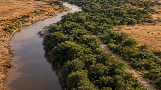
Prosopis is native to Central and South America. Several Prosopis species and hybrids were planted outside their native range in the 19th and 20th centuries, including in Australia, South Asia, and eastern Africa. It was meant to provide fuelwood, charcoal, animal fodder, and timber, stabilize soil on degraded land, and help prevent desertification.
A Scientific Reports paper that mapped the tree dates its first planting in Ethiopia to the 1970s and 80s. The trouble began in the early 1990s when the tree started to invade croplands, grasslands, riverbanks and roadsides. It estimates that within about 35 years of its introduction, it had invaded roughly 1.17 million hectares, or 12.3 percent of the region.
Deep Dive
Why was Prosopis introduced to Ethiopia, and what impact did it have?
How does Prosopis spread along the Awash River?
Have other plants introduced for practical uses also spread beyond their intended areas?
How much land it took over
The researchers used satellite images from 1986, 2000 and 2017 to monitor land cover in Afar. The largest net change of any type was Prosopis invading land, which increased by 965,000 hectares. During the period, grassland decreased by 599,000 hectares, bare land decreased by 329,000 hectares, and bush, shrub and woodland decreased by 327,000 hectares. Cropland, salt flats, settlements and waterbodies also gained area, which is why the losses add up to more than the Prosopis gain. On average, about 19,312 hectares of grassland and 10,543 hectares of bush, shrub and woodland were lost each year between 1986 and 2017, the authors estimate. They also report that approximately 50% of the lost grassland is now dominated by Prosopis. Community representatives identified climate change, recurring droughts, invasive species and weak traditional law as the four key drivers.
What it cost people
{{/usCountry}}The researchers used satellite images from 1986, 2000 and 2017 to monitor land cover in Afar. The largest net change of any type was Prosopis invading land, which increased by 965,000 hectares. During the period, grassland decreased by 599,000 hectares, bare land decreased by 329,000 hectares, and bush, shrub and woodland decreased by 327,000 hectares. Cropland, salt flats, settlements and waterbodies also gained area, which is why the losses add up to more than the Prosopis gain. On average, about 19,312 hectares of grassland and 10,543 hectares of bush, shrub and woodland were lost each year between 1986 and 2017, the authors estimate. They also report that approximately 50% of the lost grassland is now dominated by Prosopis. Community representatives identified climate change, recurring droughts, invasive species and weak traditional law as the four key drivers.
What it cost people
{{/usCountry}}The team used two approaches to estimate the impact of land changes on ecosystem-service values. The estimated average cost over 31 years was about $602 million, with a range of $112 million to $1,091 million. This is a huge cost, the authors point out, which has a major impact on rural livelihoods. The Scientific Reports paper says the Afar people’s main livelihood is still pastoralism, herding livestock along the floodplains of the Awash River during droughts. It also describes Prosopis as a source of conflict between different herding communities due to a lack of grazing land. Dr. Urs Schaffner from CABI is one of the authors of the study.
Where it could spread next
The team mapped Prosopis using satellite data and 2,722 field plots, and the model was 92% accurate. The model found that the distance to rivers, roads, and villages was more important for future spread than climate or terrain. River floods can carry pods and seeds downstream. The findings suggest the invasion along the Awash River will continue and could accelerate the loss of drought-season grazing land. More work is needed to understand how much livestock and wildlife movement adds to its spread, the authors say. They add that if it is not kept in check, Prosopis is likely to continue spreading there. It is also used for fuelwood and charcoal. Ethiopia has declared it a noxious weed and published a national management strategy, even though the tree provides firewood and charcoal.