
Sign in

Gurgaon admin to prepare 3-D maps of 100 buildings

Over the next six months, the Gurgaon administration will conduct 3-D mapping of 100 important buildings in the city, including office complexes and hospitals, to improve its disaster management plan.

Updated on: Oct 15, 2015, 16:35:36 IST
Hindustan Times | By
Share
Share via
  • facebook
  • twitter
  • linkedin
  • whatsapp
Copy link
  • copy link

Over the next six months, the Gurgaon administration will conduct 3-D mapping of 100 important buildings in the city, including office complexes and hospitals, to improve its disaster management plan.
Mini Secretariat, one of the buildings in Gurgaon with high footfall, has already been mapped using Google Tracker. (HT File Photo)

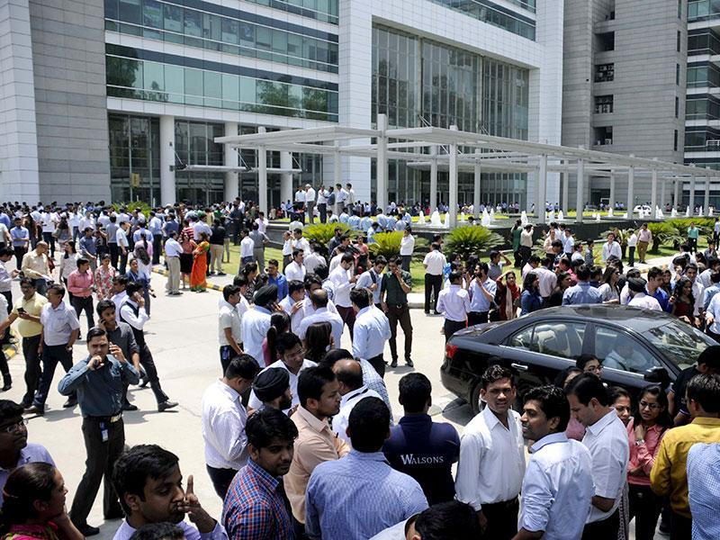
Gurgaon is highly earthquake-prone and falls under seismic zone 4, the highest being zone 5. The need for an efficient disaster management plan was realised in April this year when a 7.9 magnitude earthquake with its epicentre in Nepal shook entire north India. Several residents’ welfare associations in Gurgaon criticised the government for not having a standard disaster management plan as evacuation of office complexes and residential societies was reportedly chaotic.
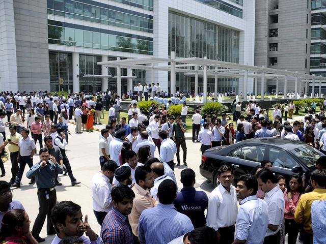
The need for an efficient disaster management plan for Gurgaon was realised in April this year when a 7.9 magnitude earthquake with its epicentre in Nepal shook entire north India. Several residents’ welfare associations in Gurgaon criticised the government for not having a standard disaster management plan as evacuation of office complexes and residential societies was reportedly chaotic. (Parveen Kumar/ HT File Photo)

Under the virtual mapping exercise, the administration will chalk out prompt and realistic evacuation plans. Three important buildings with high footfall — Sheetla Mata temple, Mini Secretariat and Vikas Sadan — have already been mapped using Google Tracker. The administration and National Disaster Management Authority will also carry out a mock disaster management drill at six sites on Thursday.

The idea to virtually map key buildings came from the terror strike on Taj Hotel in Mumbai, where responders found it difficult to understand the internal mapping of the building, additional deputy commissioner Vinay Partap Singh said. “We are using Google Tracker which gives real time 3-D imagery of the premises. We will chalk out evacuation plans based on this imagery,” said Singh, who is heading the project.

The administration will map emergency exit routes and suggest safety measures for 100 buildings. Deputy commissioner (DC) of Gurgaon TL Satyaprakash said the data will be made available to the district officials to make standard operating procedures (SOP) realistic. “We also want to set up an intelligent and responsive incident command system and ensure that response time during disasters is brought to the minimum,” he said.

Additionally, 100 civil engineers are being trained to identify buildings that are not earthquake resistant. “Nowhere in the country has such an exercise to ensure buildings are disaster-ready been taken up,” Satyaprakash said.

Read more: Have you retrofitted your house and made it earthquake-resistant in seismically volatile Delhi NCR

Through virtual mapping, disaster response teams will have access to the real images of the buildings, which will help them plan faster evacuation.

  • Abhishek Behl
    ABOUT THE AUTHOR
    Abhishek Behl

    Abhishek Behl is a Special Correspondent with Hindustan Times, Gurugram bureau. With over a decade of experience in journalism, he reports on Gurugram's rapid urban transformation, covering the city's changing infrastructure, governance, and planning landscape. His reporting spans major civic agencies, such as the Gurugram Metropolitan Development Authority (GMDA), Department of Town and Country Planning (DTCP), Haryana Shahari Vikas Pradhikaran (HSVP), and the National Highways Authority of India (NHAI). Behl has reported on key urban development issues such as RRTS projects, metro expansion, road and highway projects, water supply, drainage, mobility, environmental concerns, land use planning, affordable housing, and the city's real estate sector. He closely tracks policy decisions, infrastructure implementation, and their impact on the city and its residents. He also covers regulatory action against illegal constructions, urban flooding, traffic management, and initiatives aimed at improving civic services and sustainable development. Behl has also written on political developments in south Haryana, focusing on elections and governance. His journalism is driven by fact-based reporting, ground-level coverage, and an understanding of the social and economic dynamics of Gurugram. Apart from work he is a cyclist and a cricketer and a resident of Palam Vihar since 2010.Read More