The city recorded a total of 253mm of rainfall in about 4.5 hours on Friday morning, according to data from the India Meteorological Department’s (IMD) monitoring station in Santacruz -- representative of the city and suburbs. This marks the heaviest rainfall event of the season so far, and the second largest quantum of daily rainfall (in July) recorded over the past 10 years. The city had earlier witnessed 375.2mm of rain on July 2, 2019, as per the IMD data.
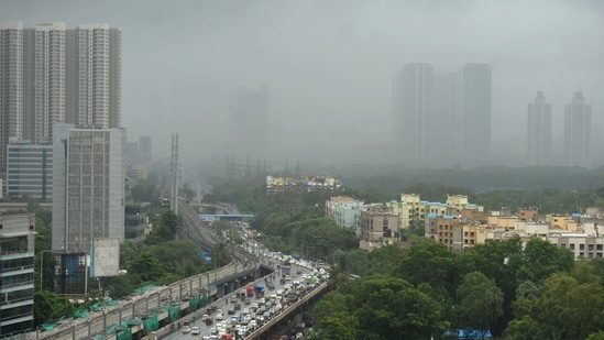
Friday morning’s rain was concentrated largely over the western suburbs and parts of central Mumbai. Rainfall data for the day shows large discrepancies in spatial distribution, which experts attributed to easterly winds that pushed the cloud cover away from south Mumbai. As a result, IMD’s observatory in Colaba recorded only 13mm of rain as of 8:30am on Friday.
“We’re still not entirely sure why this happened. Radar images from late on Thursday did not show any indication of thunderstorm formation. In the absence of typical large-scale features such as a deep layer of winds from the west over Mumbai, a monsoon low-pressure system over east or central India, or a vigorous offshore trough, even weather models would not have been able to predict this,” said Akshay Deoras, independent meteorologist and PhD student at University of Reading.
It is, however, clear from available satellite and radar images that there was a rapid formation of cloud cover over Mumbai early on Friday, around 5am, due to intense convection over the region. As winds in the lower atmosphere quickly converged and moved to higher levels forming clouds, easterly winds in upper levels steered clouds towards the Arabian Sea, saving south Mumbai and Colaba from a torrential downpour. The storm system later blew past to the south of Gujarat.
{{/usCountry}}It is, however, clear from available satellite and radar images that there was a rapid formation of cloud cover over Mumbai early on Friday, around 5am, due to intense convection over the region. As winds in the lower atmosphere quickly converged and moved to higher levels forming clouds, easterly winds in upper levels steered clouds towards the Arabian Sea, saving south Mumbai and Colaba from a torrential downpour. The storm system later blew past to the south of Gujarat.
{{/usCountry}}Friday’s showers are likely to be the “first event of this magnitude in this century to have been triggered in the absence of any Bay of Bengal monsoon low-pressure system in the month of July,” Deoras added.
There are a total of five instances between 2000 and 2020 when Santacruz received rain in excess of 250mm, all of which were attributed to low-pressure systems that formed over the Bay of Bengal.
Deoras also explained that the mountainous terrain in Mumbai’s suburbs -- specifically in Sanjay Gandhi National Park and nearby green areas -- may have driven the formation of this intense thunderstorm earlier in the day. Such thunderstorms are typically common in Mumbai during the pre-monsoon season in early June, but not so much during July, when heavy rains are driven by features such as low-pressure systems and strong offshore trough
With a total seasonal rainfall of 1545mm, the city has now surpassed the normal rainfall amount expected till end July, which is 1332.5mm. The normal rainfall between June 1 and July 16, as per IMD, is 935.8mm. In other words, Mumbai has received rainfall that is 65% in excess of the normal, up to July 16.
For the month of July alone, the city has so far received 583mm of rain, which is 70% of the cumulative average rainfall for the month, i.e. 827mm. Mumbai has also received 70% of its seasonal normal up to September-end.
In the past week alone, the city recorded at least 435mm of rain, which had been originally predicted by meteorologists but later dismissed due to the formation of a low-pressure zone in the Arabian Sea, which interfered with wind movements and kept rain bands away from the city.
Experts, like IIT-Bombay’s Sridhar Balasubramian, said it is the recent weakening of this system (about which HT had reported on July 15) that may have facilitated a “westerly burst of moisture” over Mumbai on Friday. Balasubramanian had earlier this week predicted heavy rain in the city on July 15 and 16.
It is at this point unclear how rains will play out over the next week, and in fact for the remainder of the month. The broader scenario is not conducive for a high frequency of such intense rainfall events, which are typically seen in July.
Meanwhile, prevailing wind patterns -- i.e. opposing easterly and westerly winds -- which kept rains away from Mumbai city also continue, independent meteorologists have pointed out. Mumbai has been placed under a yellow category storm warning alert on Saturday, indicating only heavy rain at isolated places (between 64.5mm to 115.5mm in 24 hours).
IMD, however, has placed Mumbai under an orange category storm warning alert from July 18 to 20, indicating “heavy to very heavy rain at isolated places”, along with chances of extremely heavy rainfall (over 204.5mm in 24 hours) in some parts.
Jayanta Sarkar, head of the IMD’s regional forecasting centre in Mumbai, said there will be widespread rainfall over the Konkan coast during the next five days, indicating more than 75% of all monitoring stations will receive some measure of rain.
Asked why IMD had not been able to forecast Friday’s heavy rains, Sarkar responded, “There are two components in forecasting. Intensity and distribution. We predicted the distribution correctly, but the intensity, which was confined to the western suburbs, could not be predicted since the cloud cover formed extremely quickly in the morning.”
Though forecasters were in agreement that Friday’s thunderstorm was near impossible to predict, they also criticised IMD for poor functioning of its doppler radar in Colaba. The radar had become defunct during heavy showers on Wednesday, and has been scanning images at intervals of every 45 minutes. A higher scan frequency would provide more actionable data for stakeholders during unexpected extreme weather events.
Independent forecasters agreed that the monsoon will continue to remain active between July 17 and 22. “But I'd be surprised if there are daily heavy rainfall events of this magnitude. Models show a low-pressure system over the Bay around next mid-week, which is stimulating the offshore trough and strengthening the westerlies, but these conditions may not necessarily trigger torrential downpours daily since there are biases associated with forecasts of low-pressure systems,” Deoras explained.
The IMD had initially placed Mumbai under a yellow category alert for Friday, but later upgraded it to an orange category alert after the thunderstorm. Despite this, the city saw only 14.1mm of rain in the eight hours ending at 5:30pm."
Stay updated with all the Breaking News and Latest News from Mumbai. Click here for comprehensive coverage of top Cities including Bengaluru, Delhi, Hyderabad, and more across India along with Stay informed on the latest happenings in World News.
Stay updated with all the Breaking News and Latest News from Mumbai. Click here for comprehensive coverage of top Cities including Bengaluru, Delhi, Hyderabad, and more across India along with Stay informed on the latest happenings in World News.