
 E-Paper



PMC to use GPR for underground utility mapping to prevent damage and improve planning
This initiative aims to create a detailed underground utility map, marking the precise locations of water pipelines, drainage lines, electrical cables, gas lines, and other essential service lines

 Prefer HTon Google


To minimise damage to underground utilities and prevent disruptions during infrastructure and construction projects, the Pune Municipal Corporation (PMC) has launched a new initiative to map the city’s underground service networks using Ground Penetrating Radar (GPR) technology.
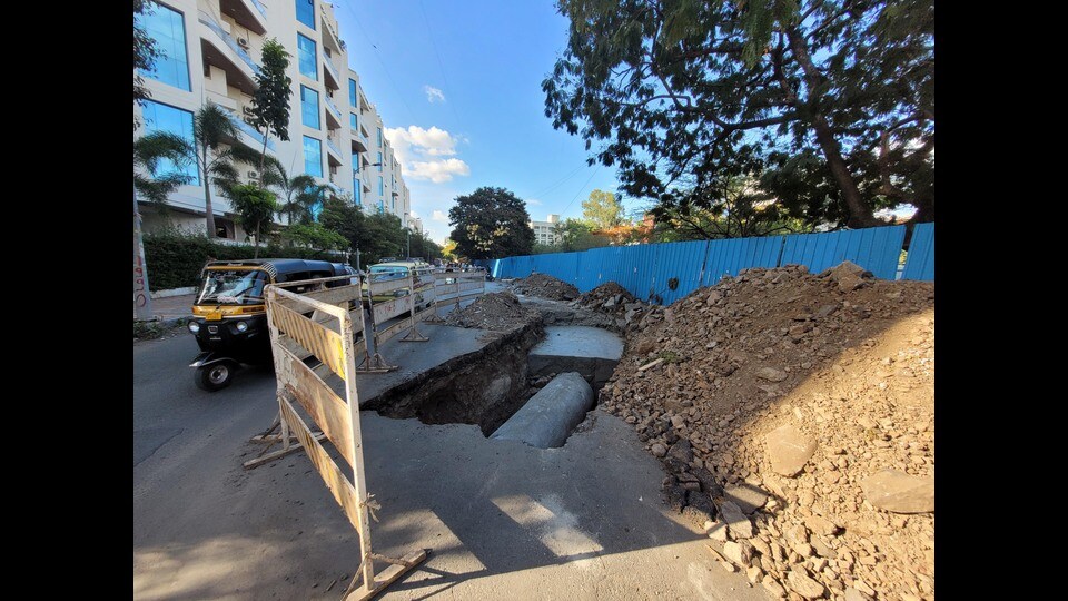
This initiative aims to create a detailed underground utility map, marking the precise locations of water pipelines, drainage lines, electrical cables, gas lines, and other essential service lines. The goal is to ensure better planning and coordination before any roadwork, metro construction, or public utility projects are undertaken.
“Pune’s roads are not only congested on the surface but also beneath it. Multiple utilities—ranging from water and drainage to telecom and power cables—are competing for space underground, making maintenance and new installations extremely challenging,” said Ganesh Sonune, head of PMC’s disaster management department.
He added, “We are using GPR technology to map the underground utilities throughout the city. This will help us identify and relocate existing lines before starting major infrastructure projects. On Tuesday, we signed an agreement with MAHAPREIT (Mahatma Phule Renewable Energy and Infrastructure Technology Limited), a government-supported company, to carry out this work. The project is part of the National Disaster Management Plan (NDMP) and is funded by the central government.”
The PMC has set aside ₹600 crore for upcoming disaster management works, with the underground utility mapping project being a key part of this plan.
Officials pointed out that GPR surveys are especially critical in planning metro lines and stations. The technology allows engineers to design around key underground utilities, like sewers and high-voltage cables, or prepare plans to relocate them ahead of construction. “These georadar systems, supported by advanced positioning and software tools, provide fast, accurate, and non-destructive mapping, which is essential in densely populated urban areas,” explained Sonune.
Currently, PMC manages over 2,200 km of road networks across Pune. However, more than 100 km of these roads are dug up each year by 14 external utility agencies—including mobile operators, CCTV networks, and the state electricity board—alongside PMC’s four internal departments responsible for water supply, drainage, stormwater lines, and street lighting.
“While we do recover restoration costs from utility agencies, the road surface rarely returns to its original condition. Delays in reinstatement and poor coordination among agencies often cause public inconvenience,” said a senior official from the PMC Road Department.
Sonune stressed that the underground mapping initiative will help reduce the need for repeated digging, improve coordination between departments, and enhance the overall quality of civic infrastructure.
Sahebrao Dandge, superintendent engineer of the Road Department, added that the new mapping system will significantly improve the city’s infrastructure planning and minimise disruptions to daily life caused by uncoordinated utility work.


