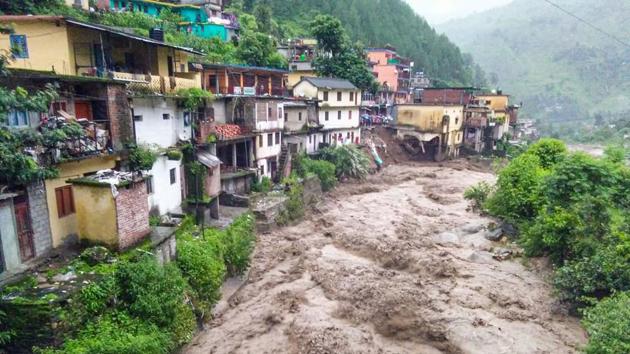
On Sunday, the Rishikesh-Badrinath Highway in Uttarakhand’s Tehri Garhwal district was blocked due to a landslide, which killed two people. In addition to the closure of this critical link, 100 more roads are also blocked due to rains. While landslides are not uncommon in this area, the latest episodes are another reminder that this geologically young region is unstable and infrastructure development has to take into account the natural fragility of the area. Otherwise, the consequences can be disastrous. For example, the 2013 Uttarakhand floods were a natural phenomenon, but the human tragedy that followed was because governments overlooked geological features and drainage patterns, and allowed illegal construction on river banks and over natural water channels.
Unfortunately, the 2013 experience has been erased from State memory. In July, the Centre approved the zonal master plan (ZMP) for the Bhagirathi eco-sensitive zone that stretches from Gaumukh to Uttarkashi (4179.59 sq km). While the Centre claims that ZMP will boost the ecology, environmentalists claim the opposite. The rush to clear ZMP is because the Centre wants to expedite the 900-kilometre Chardham Highways project, which will connect the four pilgrimage sites of Gangotri, Yamunotri, Kedarnath and Badrinath.
The project is on course despite protests against it and scientific evidence that shows the region is unstable. The Geological Survey of India’s report on the 2103 tragedy says that constructions have disturbed the natural slope of the mountains, leading to landslides. While it is true that better connectivity improves lives and livelihoods and ensures political dividends, the fragility of the area is also a reality. The government must calculate the region’s carrying capacity, and then draw up its development and tourism plans. In an era of the climate crisis, this road map is a prerequisite, not a choice.