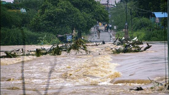
Around 51 districts in India are at a “very high” risk of floods and another 118 are at “high” risk, whereas 91 districts are at a “very high’ risk of drought and 188 are at “high” risk, according to a new study by the Center for Study of Science, Technology and Policy (CSTEP), and the Indian Institutes of Technology at Guwahati and Mandi.
The study, supported by the Centre’s department of science and technology as well as the Swiss Agency
Around 51 districts in India are at a “very high” risk of floods and another 118 are at “high” risk, whereas 91 districts are at a “very high’ risk of drought and 188 are at “high” risk, according to a new study by the Center for Study of Science, Technology and Policy (CSTEP), and the Indian Institutes of Technology at Guwahati and Mandi.
The study, supported by the Centre’s department of science and technology as well as the Swiss Agency for Development and Cooperation, has found that 11 districts are at ”very high” risk of both flood and drought, including Patna in Bihar; Alappuzha in Kerala; Charaideo, Dibrugarh, Sibsagar, South Salmara-Mankachar, and Golaghat in Assam; Kendrapara in Odisha, and Murshidabad, Nadia, and Uttar Dinajpur in West Bengal.
“This study is an effort to integrate vulnerability assessment with proneness to two hazards: flood and drought, and exposure to these hazards, to gain a comprehensive understanding of risk, using the framework proposed by the Intergovernmental Panel on Climate Change,” said the study report, titled District-Level Climate Risk Assessment for India: Mapping Flood and Drought Risks Using IPCC Framework.
Unlike the concentrated flood hazard, the drought risk is spread more evenly across the country. Sixty-five districts under the very high drought-hazard category are located in 22 states, including Uttar Pradesh, Bihar, Punjab, Tamil Nadu, Uttarakhand, Haryana, Karnataka, Rajasthan, Assam, Kerala, Nagaland and Chhattisgarh.
The report not only considered the probability of occurrence of extreme weather events in these districts but also laid down what indices may be making them particularly vulnerable.
The study’s findings underline two clear patterns: First, that flood and drought hazards are one of the driving forces behind the overall risk and two, such risk can be amplified even when the likelihood of such a hazard impacting is low, but there are chances of high exposure and the district is vulnerable.
“For example, in some districts if the population is too low then the exposure will be lower and if the district has better coping mechanisms such as say irrigation (in case of drought hazard), crop insurance for farmers, more people taking up the 100 day work programme (Mahatma Gandhi National Rural Employment Guarantee scheme) then those districts will be less vulnerable and hence not at high risk,” explained professor NH Ravindranath from the Indian Institute of Science who was advisor for the risk mapping project.
The core team prepared indices for hazard, exposure and vulnerability to arrive at risk indices. The team consulted state level climate change cells to arrive at very localised information. “Unfortunately for many districts the team used census 2011 data which is old but a lot of more recent information between 2019 and 2021 was also used by the team to develop these indices,” added Ravindranath.
An area is considered under the risk of drought hazard if precipitation systematically falls below the long-term average. The indicators of flood exposure are population density and the proportion of area under agriculture. Drought exposure is calculated based on population density and area under rainfed agriculture. Vulnerability is a system property. Its indicators are MPI, the proportion of marginal and small landholdings, yield variability of food grains, the composite MGNREGA index, the female literacy rate, forest area per 100 rural population, health infrastructure available per 100 square kilometres, the livestock-to-human ratio, the proportion of area under crop insurance, the proportion of net sown area under horticulture, and road density.
For example, Patna (Bihar) and Majuli’s (Assam) flood risk indices are comparable. However, the profiles of these two districts are completely different in terms of hazard, exposure, and vulnerability. While the flood hazard index is very high in Majuli, it is much lower in Patna. But Patna has very high exposure owing to dense population and high vulnerability.
“The advice to districts at high risk of floods and droughts is to reduce their vulnerability. For example, Anantapur in Andhra Pradesh which is at high risk of drought should focus on agro-forestry, irrigation, organic or natural farming to improve soil health,” said Ravindranath.
HT reported in January that more than half of India’s administrative units (or tehsils) saw an increase in monsoon rainfall in the 2012-22 decade over the 30-year, 1982-2011 baseline; 11%, all key agricultural hotspots saw a decline; and almost two-thirds witnessed an increase in the frequency of heavy rainfall. The results of the large-scale study, “Decoding India’s Changing Monsoon Patterns”, by the Council on Energy, Environment and Water (CEEW) , provide a granular picture of the changing and erratic monsoon patterns in India.
According to the study, around 55% of India’s 4000-plus tehsils have witnessed an increase in monsoon rainfall in the past decade (2012-22) by at least 10%, compared to the climatic baseline (1982–2011). Most of this increase was recorded in the traditionally drier regions of Rajasthan, Gujarat, central Maharashtra, and parts of Tamil Nadu.
One Subscription.
Get 360° coverage—from daily headlines
to 100 year archives.
Archives
HT App & Website