
 E-Paper



J&K goes full throttle to geotag forests
Jammu and Kashmir has around 21,122 sq km of forest area which is around 48% of the total geographical area; of these forests, 4,203 sq km area has been categorised as ‘very dense’, while 8,969 sq km and 21,122 sq km fall under ‘moderate dense’ and ‘open’ forests, respectively


The J&K administration is actively geo-tagging the forest land across the UT and has so far erected thousands of geo-tagged boundary pillars across 20 districts.
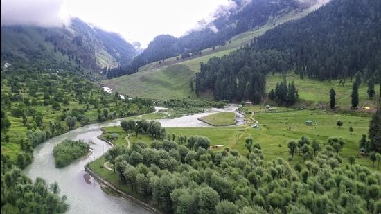
As per the official figures J&K has around 21,122 sq km of forest area which is around 48% of the total geographical area. Of these forests, 4,203 sq km area has been categorised as ‘very dense’, while 8,969 sq km and 21,122 sq km fall under ‘moderate dense’ and ‘open’ forests, respectively.
So far, only 31.99% forest area has been demarcated by fixing or establishing precast or in-situ pillars. Around 91,175 boundary pillars have been fixed in the 2,168 forests that have been surveyed or records for which are available with the forest department.
“Geo-tagging of forests helps in boundary consolidation, encroachment eviction and improved forest management. The process helps in accurate assessment of boundaries which helps in resolution of land disputes. It also prevents encroachment attempts on forest land,” said conservator of forest s (north circle) Irfan Rasool in whose jurisdiction many forest areas has already been geo-tagged in the past few years.
Officials said that earlier, the forest department used to erect simple metal or cement poles to demarcate the forest land. “However, at many places the poles got damaged that paved way for forest destruction and the land encroachment. Though the process of demarcation began in 1920, it picked up pace only after 60s as thousands of precast boundary pillars were fixed for the demarcation in past many decades,” they added.
2010 onwards, all the pillars have been geo-tagged after getting records from the department maps that are with various forest divisions.
As per the official figures of last many decades, 2,85,000 boundary pillars were fixed in the forests for protection of the land. “After introduction of geo-tagging, 34,077 in-situ pillars have been established in various forests in the J&K which is more than 32% of total boundary pillars. Besides, the department has also fixed 57,098 precast pillars in different forests that too were geo-tagged,” officials said, adding that so far 1,873 forests have been surveyed for proper demarcation and geo-tagging.
Officials said that in coming years there is a a proposal that 2,48,944 in-situ pillars will be geo-tagged on which government is going to spend around ₹174 crore. “The pace is very slow and it will take many years to complete the process. The process needs to be accelerated for safety of the forests,” said a senior officer in the forest department.
Irfan Ahmad, system analyst, Central University of Kashmir, said that geo-tagging has revolutionised the way we have been tracing and managing the assets of different types and forests are no alien to this revolution.
“This is a very good step that was taken by the government in the last two decade. GIS data is useful for forest management, because most of the forests are depleting at an enormous rate due to the increasing rate of urbanisation and agriculture. GIS mapping of the forests can reduce the encroachment on real-time basis if multilayered-site representation is used while mapping the forests. Moreover, GIS, when integrated with remote sensing, can act as a great tool for management of forests.”


