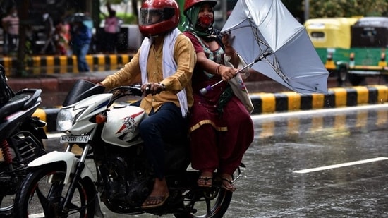
Starting off as an unusually hot month, July ended up with 507mm of rain -- twice the city’s average of 210.6mm for the month, making it the wettest in the past 18 years, another weather extreme that was characteristic of the patterns being observed in the capital since August 2020.
The city has been breaking a weather record every month since August 2020. For instance, this February was the second warmest in 120 years, with the mean maximum temperature in the month touching 27.9 degrees Celsius (°C), falling marginally short of the all-time record of 29.7°C in 2006.
Then March this year recorded the hottest day in 76 years, with the mercury levels touching 40.1°C on March 29.
But then, after a sweltering February and March, the conditions changed again in April and the lowest minimum temperature in at least a decade was recorded on April 4, at 11.7°C.
July 2021 has kept with the record-breaking pattern: it started off with an unusually hot day when the maximum temperature spiked to 43°C. Over the next eight days, there were four heatwave days – a frequency not seen since 2014. Around this time, the monsoon should have arrived – but it would not till nearly the middle of the month on July 13, which was the latest onset since 2013. And in a span of three weeks, the monsoon has now dumped more rain this month than it did in any year since 2003.
Kuldeep Srivastava, head of India Meteorological Department (IMD) regional weather forecasting centre, said Delhi has received “excess” rainfall this July, adding that more rain is expected over the next couple of days.
{{/usCountry}}Kuldeep Srivastava, head of India Meteorological Department (IMD) regional weather forecasting centre, said Delhi has received “excess” rainfall this July, adding that more rain is expected over the next couple of days.
{{/usCountry}}“More showers are expected over the next couple of days. Given that the month of August, when the city receives its maximum rainfall, is beginning, we may have a slightly above normal monsoon this year. However, we have to watch out for how much it rains in September. Even last year, August received very good rainfall but September went almost dry, making it slightly below normal monsoon,” he said.
Besides registering a record for the month, the rain over the city was erratic and inconsistent in its geographical pattern. The rain spells have also been short and intense, instead of being uniformly spread over the month, with some areas getting heavy rain on days when others got trace or no rain.
Though Safdarjung station recorded 507.1mm rain, Aya Nagar weather station received 295.7 mm rainfall.
This phenomenon can also be seen in the rain data of July 30, when Safdarjung observatory received 41.6 mm rain between 2.30pm and 5.30pm, but barely two kilometres away, at the Lodi Road station, showers were more intense (62mm). Similarly, on July 29, when rains lashed Safdarjung (72mm) and Lodi Road (73.4mm), areas around southwest Delhi’s Palam observatory were almost dry.
RK Jenamani, senior scientist at the IMD, explained, “Rainfall does vary within a few kilometres. On Friday, around the Lodi Road area clouds suddenly built up from the east, and there were already favourable weather systems. Local land use and land cover also impact weather activities in an area.”
Private weather forecasters also said that a change in monsoon patterns, which is being observed over the region over the last few years, was more prominent this season.
Mahesh Palawat, vice-president (meteorology and climate change) at Skymet Weather, a private weather forecasting agency, said the change in pattern is being observed because over the last few years most of the rain received in this region was through convective clouds, which cause short, more intense rain spells that cover a smaller area.
“Convective clouds, unlike sheet clouds (altostratus clouds), cover a smaller area. So, there are chances that one area might receive intense rainfall and another, just within its 8-10km radius would be completely dry. Earlier, the clouds used to cover 300-400km radius of area and the showers would also be more uniform and continue till days,” Palawat said.
This can be seen from the fact that the rain recording of 507.1mm at Safdarjung in July was a result of just nine days of rain in Delhi. Till 2001, Delhi used to record an average of 15-20 days of rains in July.
Forecasters also said that August is likely to be an “above average” monsoon month for Delhi.
“Looking at the forecast, it does seem like August will also record a surplus for Delhi. The coming few days are also favourable for moderate to heavy rains in Delhi and NCR,” Palawat added.
Stay updated with all top Cities including, Bengaluru, Delhi, Mumbai and more across India. Stay informed on the latest happenings in World News along with Delhi Election 2025 and Delhi Election Result 2025 Live, New Delhi Election Result Live, Kalkaji Election Result Live at Hindustan Times.
Stay updated with all top Cities including, Bengaluru, Delhi, Mumbai and more across India. Stay informed on the latest happenings in World News along with Delhi Election 2025 and Delhi Election Result 2025 Live, New Delhi Election Result Live, Kalkaji Election Result Live at Hindustan Times.