
 E-Paper



Navigation route row: Weren’t consulted on coastal road project, Fisherfolk tells BMC
Fisherfolk has reiterated that they were not consulted during the coastal road project planning stage and that the civic body’s assurance of compensation, though important, is not in line with their primary demand of a redesign in the interchange. BMC had, on Tuesday, said that the navigation span as per current design specifications is sufficient.


Worli fisherfolk on Wednesday responded to the Brihanmumbai Municipal Corporation’s (BMC) statement over the ongoing navigation route row, relating to the coastal road-Bandra Worli sea link (CR-BWSL) interchange. Fisherfolk has reiterated that they were not consulted during the project planning stage and that the civic body’s assurance of compensation, though important, is not in line with their primary demand of a redesign in the interchange. BMC had, on Tuesday, said that the navigation span as per current design specifications is sufficient.
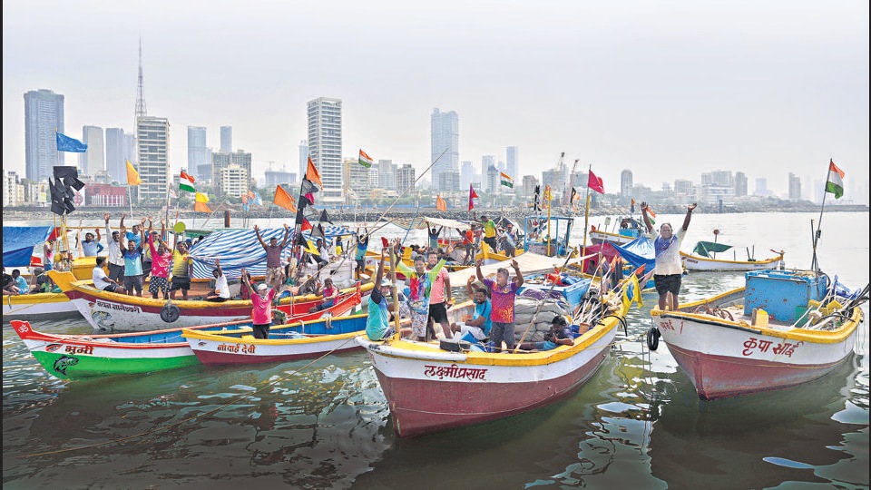
“The first point of BMC statement mentions that our two fishing societies were consulted before the fisheries department granted the no-objection certificate (NOC) in 2017. This is false. We were not consulted before the NOC was granted,” states a note issued on Wednesday by Worli fisherfolk.
“We have made multiple representations to the BMC and other relevant authorities since 2018 pointing out repeatedly that the navigation span provided for the coastal road is insufficient and unacceptable to us, but we have not received a response to our letters, nor were we called for a meeting to explain our concerns,” the note continues.
Nitesh Patil, president of the Worli Koliwada Nakhava Matsyavyavsay Sahakari Society, explained that the span between the Bandra Worli sea link in front of Cleaveland Bunder (which faces a threat of permanent closure due to the interchange) is already very narrow, and the Coastal Road connector bridge will add more columns in this precarious route. “This series of columns will make it impossible for us to navigate the rocksand strong currents,” he said.
BMC in its statement referred to the Bureau of Indian Standards’ Code of Practice for Design of Ports and Harbours (IS:4651), which specifies that a “navigation span is required to be 5 times the width of the boat for single carriage and 8 times the width of the boat for double carriage.”
Referring to data obtained from the fisheries department, BMC has said that the largest registered vessel operating in Worli Koliwada is 3.8 metres wide, and accordingly the navigation span for boats operating from the koliwada “should be kept at a maximum of 30.4 meters for double carriage.” “The Mumbai Coastal Road Project has a navigation span of 60 meters, which is almost double prescribed the navigation span,” the BMC’s statement said.
Fisherfolks have responded saying that the IS:4651 standards are meant for harbour entrance channels, and not for bridge columns in the open sea, as is the case with the CR-BWSL interchange. Moreover, this standard specifies the minimum requirement for navigation routes and not the permissible maximum requirements. “The appropriate distance for navigation ought to be based on the specific geomorphic conditions and tide pattern and currents. The standards do not say that large spans cannot be built,” the fisherfolks’ statement said.
Officials in the BMC’s coastal roads department did not respond to requests for comment.
Stay updated with all the Breaking News and Latest News from Mumbai. Click here for comprehensive coverage of top Cities including Bengaluru, Delhi, Hyderabad, and more across India along with Stay informed on the latest happenings in World News.


