This year, the city experienced its highest June rainfall since 2014, recording a total of 267.5 mm—significantly higher than the average June rainfall of 166.3 mm. The surge in rainfall is part of a broader trend of above-normal monsoon activity across parts of Maharashtra, particularly in Konkan and central Maharashtra, which has been attributed to favourable weather systems that developed during the month and helped revive the monsoon after an early but sluggish onset.
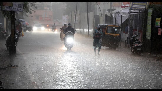
After the monsoon arrived early in the state in May, rainfall activity largely stalled for nearly 20 days in June. It wasn’t until the second half of the month that the monsoon picked up strength, bringing substantial rainfall to Konkan and central Maharashtra and to a lesser extent, to Vidarbha. According to the India Meteorological Department (IMD), Maharashtra received 222.3 mm of rainfall in June against a normal of 209.8 mm, placing the overall state rainfall under the ‘normal’ category—defined as rainfall within ±19% of the long-period average. This year’s June total is 6% above average.
Despite this overall normal classification, the rainfall distribution across districts was highly uneven. While eight districts, particularly in Konkan and central Maharashtra, experienced significantly above-normal rainfall, large swathes of the state—especially in Vidarbha and Marathwada—continued to face major rainfall deficit. Washim recorded the highest deficiency at 86%, with only 18.3 mm of rainfall received against the normal 132.3 mm. At least eight districts in Maharashtra are facing a ‘large deficiency’ with rainfall shortfall ranging from 60% to 90%, while another 10 districts come under the ‘deficient’ status, with rainfall departures between 20% and 59% below normal. Besides Washim, districts like Ahilya Nagar (formerly Ahmednagar), Chhatrapati Sambhaji Nagar
(formerly Aurangabad) and Solapur are also among those facing significant rainfall shortfall.
{{/usCountry}}(formerly Aurangabad) and Solapur are also among those facing significant rainfall shortfall.
{{/usCountry}}At the opposite end of the spectrum, Palghar emerged as the wettest district in June, recording an extraordinary 701.9 mm of rainfall—nearly 137% higher than its normal average of 295.7 mm. Nashik and Pune followed with rainfall surpluses of 118% and 105%, respectively. Pune district overall received 291.5 mm of rainfall in June, far surpassing the normal 141.9 mm.
Going by sub-divisions, central Maharashtra was the only region to receive ‘excess’ rainfall, with a positive deviation of 35% from the norm. The region recorded 213.2 mm of rainfall against the normal 157.7 mm. Konkan and Vidarbha both fell within the ‘normal’ category, with Konkan recording a 12% surplus and Vidarbha showing a 12% deficit—both within the permissible range of ±19%. However, Marathwada stood out with a worrying 41% rainfall deficit, having received just 78.8 mm against a normal of 134.7 mm for June.
Weather experts have linked this uneven rainfall pattern to the lack of strong weather system formations in the Bay of Bengal, which typically bring good rainfall to eastern Maharashtra. “There was no strong system formation in the Bay of Bengal, which usually benefits Vidarbha and Marathwada. As a result, these regions have faced substantial deficits,” explained Anupam Kashyapi, former head of the weather and forecasting division at IMD Pune.
By contrast, several robust systems developed over the Arabian Sea in June, strengthening the westerly winds and resulting in heavy rainfall across Palghar, Nashik, Pune, and the ghat sections of Satara district. These favourable developments led to improved rainfall performance in parts of western Maharashtra.
BOX
Forecast ahead
Looking ahead, monsoon activity is expected to intensify further. S D Sanap, senior meteorologist at IMD Pune, stated that the monsoon is currently in an active phase. A low-pressure area lies over the northwest Bay of Bengal and adjoining regions of West Bengal and Bangladesh, with an associated cyclonic circulation extending up to the mid-tropospheric levels. This system is likely to move slowly in a west-northwest direction over north Odisha, Gangetic West Bengal, and Jharkhand over the next two days.
Additionally, an upper air cyclonic circulation is positioned over south Rajasthan and adjoining north Gujarat at lower tropospheric levels. Under the influence of these systems, heavy to very heavy rainfall is expected in coastal Maharashtra and the ghat sections of Pune, Satara, and Kolhapur districts. Consequently, the IMD has issued an orange alert for these areas on July 2 and 3. Vidarbha is expected to see moderate to isolated heavy showers for which, a yellow alert has been issued till July 3. Pune city will likely experience cloudy weather during this period, while its ghat sections could see intense rainfall.
As the monsoon progresses, weather scientists and IMD officials stress the need for close monitoring and readiness, especially in areas vulnerable to flooding or those experiencing deficient rainfall.