The Pune Metropolitan Region Development Authority (PMRDA) has constituted a dedicated team to use drones for land surveys and demarcation of lands for various developmental projects such as the Indrayani River rejuvenation, urban planning initiatives, 65 metres’ inner Ring Road etc.
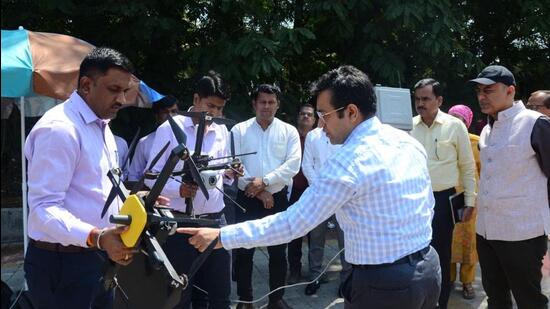
Ramdas Jagtap, additional collector of the PMRDA, said, “The PMRDA has purchased three drones of ₹25 lakhs for land surveys and demarcation of lands for various projects. We have formed a team of four members, which includes three government-certified drone pilots. The team conducts land surveys and demarcation of lands for different projects. We have used drones for conducting surveys of 105 km of the Indrayani River for its rejuvenation. Besides that, we have carried out land surveys for Maan-Mhalunge and other townships and road development projects. We are also carrying out a survey of the 65 metres’ inner Ring Road. The usage of drones provides minute and accurate details along with images, land contours, land size, altitude and longitude.”
“Using drones saves time and manpower. We conducted the Indrayani River survey within two-and-a-half months. It would have taken around a year if we had used the traditional way to conduct a survey. Sometimes, we face resistance from local residents. They confront officials. It takes time to convince them. Drone surveys save time and avoid confrontation also. After conducting a drone survey, we cross-check the details with the government land records’ department,” Jagtap said.
{{/usCountry}}“Using drones saves time and manpower. We conducted the Indrayani River survey within two-and-a-half months. It would have taken around a year if we had used the traditional way to conduct a survey. Sometimes, we face resistance from local residents. They confront officials. It takes time to convince them. Drone surveys save time and avoid confrontation also. After conducting a drone survey, we cross-check the details with the government land records’ department,” Jagtap said.
{{/usCountry}}Meanwhile, the PMRDA initiative of drone surveys was lauded at the ‘Geo Smart 2023 International Conference’ held in Hyderabad from October 17 to 19. At this conference, Dr Suhas Diwase, former metropolitan commissioner, showcased the various achievements of the drone project. Esteemed personalities such as former chairman of the Indian Space Research Organisation (ISRO), Kiran Kumar, lauded the PMRDA drone initiative. The ‘Geo Smart 2023 International Conference’ prominently featured the ISRO and the National Remote Sensing Centre (NRSC), highlighting their pivotal role in advancing the remote sensing and GIS sector in India.