The Uttarakhand Space Application Centre (USAC) has developed a geographic information system (GIS) mapping-based portal for efficient crowd management in the upcoming Haridwar Mahakumbh using satellite imagery.
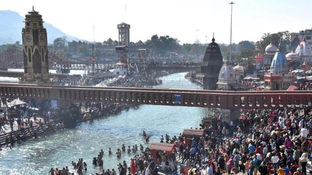
The portal, covering about 160 sqkm area of the Mahakumbh known as mela area, will provide realtime information to the authorities about movement or concentration of crowds, said officials.
MPS Bisht, director USAC said, “The system built using GIS mapping is the first of its kind to be used in the management of any of the mahakumbhs held in the country.”
Base map covering mela area of 161 sqkm created
Bisht said, “Under the developed mechanism, we created a base map of the mela area covering an area of about 161 sqkm. It was made by 15 students of geology at the Garhwal Central University by collecting data on the ground, which includes locations of camping site, sewer lines, medical facilities, toilets and other basic amenities for the pilgrims.”
Also Read: Uttarakhand HC directs state govt to file affidavit on Covid-19 preparedness for Mahakumbh 2021
He said that after the data was collected, it was then integrated with the satellite imagery to provide realtime data to the authorities.
{{/usCountry}}He said that after the data was collected, it was then integrated with the satellite imagery to provide realtime data to the authorities.
{{/usCountry}}“As per the system, a war room will be built in the mela authorities’ headquarters where the officials can avail realtime data of crowd movement to manage the mega event,” said Bisht.
Mobile application for pilgrims to check crowd and water level at ghats on realtime basis
The USAC director said that as part of the system, there would also be a mobile application for pilgrims to help them avail various facilities without much hassle.
“Using the application, they can get realtime information about crowd concentration on the ghats by which they can decide on which ghat they should visit to take a holy dip. Similarly, they can also see the water level at the ghats and decide accordingly about taking the bath,” said Bisht.
He also said that the “easy to use” application will also help pilgrims with the location of various important basic amenities like lodging and transportation.
“As we have included the information about the hotels and lodges in the application, the pilgrims can find which hotels have how many rooms vacant. They can also find about the nearest taxi stand or bus stop for their destination just by using the application,” said Bisht.
While the portal was to cover all 41 sectors of the mela area, the number is now reduced to half due to the Covid-19 pandemic.
“The portal will likely cover only about 21 sectors now as authorities are expecting less of a crowd due to the pandemic,” said Bisht.