Several parts of the Indo-Gangetic Plains region recorded dense to very dense fog on Saturday morning resulting in very low to zero visibility. Siliguri, for example, recorded zero visibility; Bareilly and Lucknow recorded less than 25 m visibility each; Amritsar, Baharaich, Purnea and Gaya recorded less than 50 m each and Jhansi 200 m at 5.30 am, according to India Meteorological Department.
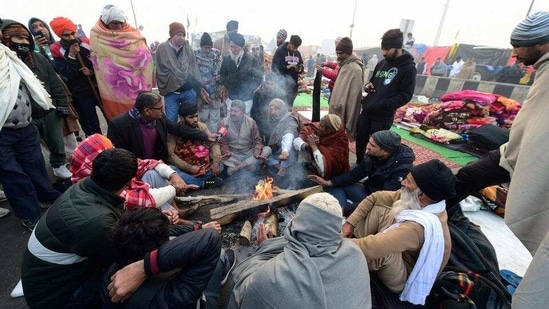
On Friday, cold day to severe cold day conditions were recorded at many places in east Uttar Pradesh, at a few places in west Uttar Pradesh and at isolated places in Haryana, where the day temperatures dipped very low.
Cold wave to severe cold wave conditions existed at many places over Punjab, at a few places over Haryana and east Rajasthan and at isolated places over Jammu & Kashmir, Uttarakhand, Delhi, Uttar Pradesh and west Rajasthan.
The lowest minimum temperature over plains of northwest India was -0.3°C recorded at Bathinda on Friday.
Cold, dry north westerly winds, which are blowing over the northern plain and adjoining parts of central India, are likely to prevail for the next 2-3 days. Under their influence, cold wave to severe cold wave conditions are very likely over Punjab, Haryana, Chandigarh, Delhi, Rajasthan and Uttar Pradesh during the next 3 days and a decrease in spatial distribution and intensity thereafter.
Cold wave conditions are also likely over Jammu and Kashmir, Ladakh, Gilgit-Baltistan, Muzaffarabad, Uttarakhand and Madhya Pradesh, during the next 2 days. Cold wave conditions are likely to stay over Himachal Pradesh during the next 24 hours and over Bihar during Jan 31 to Feb 3.
{{/usCountry}}Cold wave conditions are also likely over Jammu and Kashmir, Ladakh, Gilgit-Baltistan, Muzaffarabad, Uttarakhand and Madhya Pradesh, during the next 2 days. Cold wave conditions are likely to stay over Himachal Pradesh during the next 24 hours and over Bihar during Jan 31 to Feb 3.
{{/usCountry}}Ground frost is likely over Jammu & Kashmir, Ladakh, Gilgit-Baltistan, Muzaffarabad, Himachal Pradesh, Uttarakhand, Punjab, Haryana, Chandigarh, Delhi, West Uttar Pradesh and north Rajasthan during the next 2 days.
Dense to very dense fog is expected in many pockets over Punjab and Haryana, Chandigarh, Delhi during the next 24 hours; over Uttar Pradesh during the next 2 days and over Bihar during the next 3 days.
Cold day to severe cold day conditions are likely in pockets over Uttar Pradesh and Bihar during the next 5 days and over Madhya Pradesh during the next 2 days.
A fresh Western Disturbance is likely to affect the western Himalayan region from the night of January 31 onwards. The WD is likely to bring widespread rain and snow over the hills and thunderstorms in some parts of the northern plains. Minimum temperatures are likely to drop again after the WD passes on Feb 3.
According to the IMD, a cold day or severe cold day is classified as such on two parameters—a minimum temperature of under 10 degrees and maximum temperature being 4.5 degree C or 6.4 degrees C below normal.