E-Paper



Biparjoy was supercharged twice by the unusually warm Arabian Sea: Experts
An unusually warm Arabian Sea with wind conditions that helped it sustain for 144 hours, Biparjoy was fueled by extreme energy from the ocean, say experts.

 Prefer HTon Google


Cyclone Biparjoy, which is expected to make landfall in Gujarat on Thursday, underwent rapid intensification twice during its lifecycle after it developed on June 7, experts said on Monday.
According to data with the Joint Typhoon Warning Centre (JTWC), between June 6-7, Biparjoy’s wind speed increased by 84 kmph from 55 kmph to 139 kmph and between June 9-10, its wind speed increased by 75 kmph from 120 kmph to 195 kmph.
Cyclone Biparjoy is now over eastcentral Arabian Sea and expected to cross Saurashtra, Kutch and adjoining Pakistan coasts between Mandvi (Gujarat) and Karachi (Pakistan) near Jakhau Port (Gujarat) by noon on Thursday as a very severe cyclonic storm with maximum sustained wind speed of 125-135 kmph gusting to 150 kmph.
Such rapid intensification of cyclones over Arabian Sea is unusual and dangerous, experts said.
An unusually warm Arabian Sea with wind conditions that helped it sustain for 144 hours, Biparjoy was fueled by extreme energy from the ocean, experts added.
Also Read: PM Modi likely to hold review meeting today as Cyclone Biparjoy intensified
“Conducive ocean conditions with high sea surface temperature of 31°C and strong upper- level outflow has aided the rapid intensification of this cyclone. Cyclone Biparjoy has been at least a Category 1 cyclone (hurricane strength) for 114 hours. According to JTWC, this is the longest duration for an Arabian Sea cyclone with at least category 1 cyclone strength (>120 kmph) in satellite era (since 1982). It is likely to be the longest-lived cyclone with wind speed of over 35 knots (cyclone strength) over Arabian Sea by June 14,” said Vineet Kumar Singh, researcher from Typhoon Research Centre, Jeju National University.
This implies that Biparjoy was sustained and continued to intensify because of the heat and energy contributed by the Arabian Sea while it moved very slowly over the past five days as it was between two high pressure zones which determined its movement.
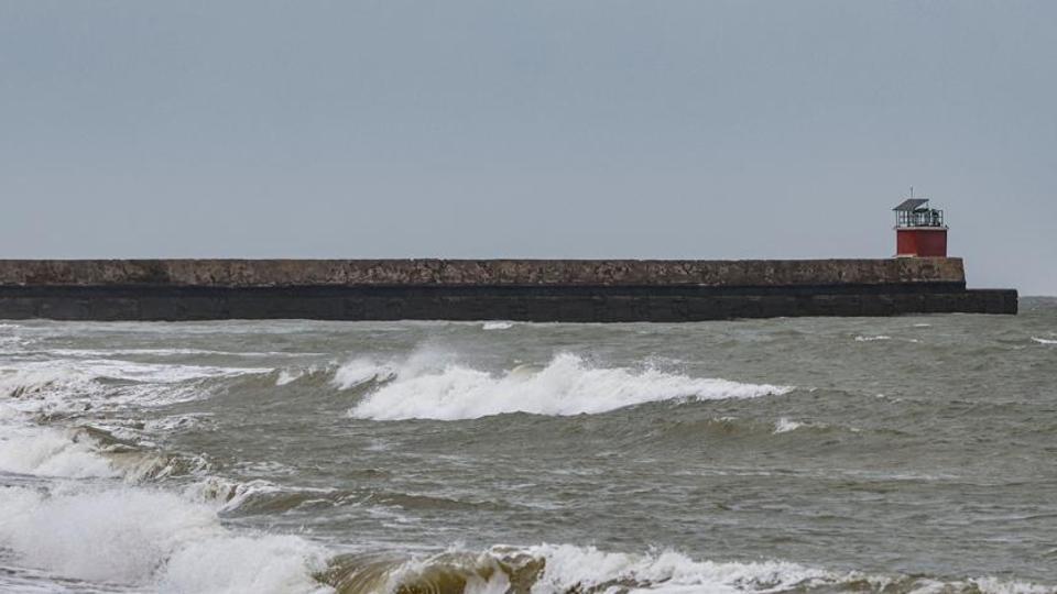
The result is massive waves and expected storm surge.
“As a result of #ESCS #Biparjoy, the Indian coasts are experiencing high waves. The Open Ocean Buoy shows wave heights exceeding 8.3 m & the Wave Rider Buoy shows 4m near Veraval Coast and are well matching with @ESSO_INCOIS predictions,” the Indian National Centre for Ocean Information Services shared on their official Twitter page on Sunday.
Roxy Mathew Koll, climate scientist at Indian Institute of Tropical Meteorology, said, “Wave rider buoy by INCOIS at Veraval shows 4m high waves. Storm surge forecasts indicate 5-8m high waves in the open seas. As cyclone intensity increases with Arabian Sea warming, these storm surges are also becoming larger. We need more wave buoys to monitor these along the coast and the open seas.”
Gujarat
The storm’s intensification has already resulted in high tides along the coastal areas of Dwarka, with reports of high waves near Gomti Ghat in Gujarat’s Dwarka and Mumbai in Maharashtra.
As the cyclone approaches, gusty winds and high tides are expected to persist, amplifying concerns for the safety of coastal communities.
The India Meteorological Department’s (IMD) orange alert for the Saurashtra and Kutch coasts underscores the urgency for preparedness and evacuation measures.
Schools in Saurashtra, including Devbhumi Dwarka, Jamnagar, Junagadh, Porbandar and coastal areas of Kutch were shut down on Monday.
With maximum sustained wind speeds of 125-135 kmph, gusting up to 150 kmph, Cyclone Biparjoy poses a significant threat to the Gujarat coast.
The impending landfall of Cyclone Biparjoy on June 15 has prompted authorities to issue warnings and alerts in the affected regions.
The storm’s projected path indicates a potential impact on the Gujarat coast, with Porbandar, Devbhumi Dwarka, Jakhau Port, Naliya, and neighboring areas expected to bear the brunt of its fury.
The intensity of the cyclone, coupled with its sustained wind speeds, poses a significant risk to life and property.
Total suspension of fishing operations has been advised over the Gujarat Coast and the central and adjoining North Arabian Sea until June 15.
Fishermen currently at sea are urged to return to the coast promptly to avoid being caught in the cyclone’s path.
The cyclone may also cause bending or uprooting of power and communication poles, major damage to roads and railways, disruption of overhead power lines and signaling systems, and flooding.
Widespread damage to standing crops, plantations, and orchards is likely.
Small boats and country crafts are at risk of detaching from moorings, and visibility will be severely affected due to salt spray, the IMD said.
As the cyclone progresses, heavy rainfall is forecasted in various districts.
On June 14, Kutch, Devbhumi Dwarka, Porbandar, Jamnagar, Rajkot, Junagadh, and Morbi districts of Saurashtra and Kutch are likely to experience light to moderate rainfall, with heavy to very heavy rainfall at isolated places.
The intensity of rainfall is anticipated to increase on June 15, with heavy to very heavy rainfall expected in the same districts.
Additionally, isolated heavy rainfall is expected in the remaining districts of Saurashtra and the north Gujarat region.
On June 16, north Gujarat and adjoining south Rajasthan are likely to receive light to moderate rainfall, with heavy to very heavy rainfall at isolated places.
The IMD has issued specific wind warnings to alert residents and prepare them for the cyclone’s impact.
Gale wind speeds ranging from 165-175 kmph, gusting to 195 kmph, are predicted over the northeast and adjoining eastcentral Arabian Sea on June 12.
While the wind speeds are expected to decrease slightly in the following days, they will remain hazardous.
Moreover, the IMD has issued storm surge warnings for Kutch, Devbhumi Dwarka, Porbandar, Jamnagar, and Morbi districts, cautioning that storm surges of about 2-3 meters above the astronomical tide could inundate low-lying areas during landfall.