New Delhi: Following intense rain through the majority of July, which caused floods, landslides and damage to infrastructure particularly in the country’s north, north-west and along the west coast, August will likely see a gradual lull in rainfall with monsoon set to enter a “weak phase”, weather models indicate.
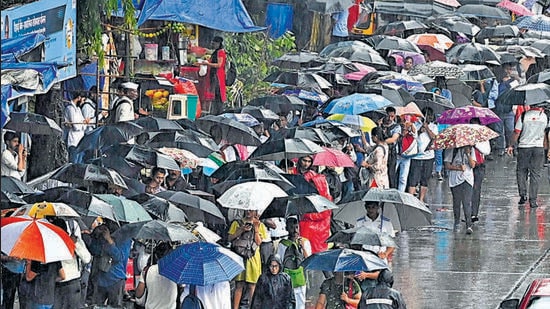
Heavy rains across India’s north and west in July have also meant that the nationwide rainfall deficit of 10% at the end of June was overturned and there is now 5% excess rain over the country, according to India Meteorological Department (IMD) data.
While this trend of heavy rains is expected to continue over the next three days, the intensity is likely to fall from the first week of August with the start of the influence of El Nino, experts said. This will lead to what weather scientists call “break conditions” – a common phenomenon during the monsoon season.
“The latest extended range forecast from a couple of leading climate prediction centres suggest monsoon is entering a weak phase during first week of August, and then a classic break condition during the second week. There is a suggestion that it may extend into the third week also,” said M Rajeevan, former secretary, ministry of earth sciences. “This break is very much inevitable after a long active monsoon spell... The El Niño influence could be more seen on Indian monsoon.”
The development of back-to-back weather systems with hardly any gap, has led to severe rainfall in parts of the country throughout July, particularly India’s north including Himachal Pradesh and Uttarakhand and the west coast, from Konkan to Gujarat. Himachal Pradesh and Uttarakhand saw landslides, mudslides, massive damage to bridges, highways and other infrastructure last week, leading to hundreds of deaths. Even the national capital has not been spared with Delhi getting inundated due to a record-shattering rise in Yamuna levels from the second week of the month. A flood alert still in place in the Capital as of Wednesday.
{{/usCountry}}The development of back-to-back weather systems with hardly any gap, has led to severe rainfall in parts of the country throughout July, particularly India’s north including Himachal Pradesh and Uttarakhand and the west coast, from Konkan to Gujarat. Himachal Pradesh and Uttarakhand saw landslides, mudslides, massive damage to bridges, highways and other infrastructure last week, leading to hundreds of deaths. Even the national capital has not been spared with Delhi getting inundated due to a record-shattering rise in Yamuna levels from the second week of the month. A flood alert still in place in the Capital as of Wednesday.
{{/usCountry}}Interestingly, IMD had earlier forecast that below normal rainfall is likely over many areas of northwest, northeast and southeast peninsular India in July.
The national figure of 5% excess rain as of July 26, however, glosses over wide region-wise variations – there is a 34% excess over northwest India; a 25% deficiency over east and northeast India; a 14% excess over central India and 2% excess over peninsular India.
Three states – Gujarat (90% excess rain), Rajasthan (+77%) and Himachal Pradesh (+69%) – have seen the most deviation from normal this season, while Punjab, Jammu and Kashmir, Uttarakhand, Haryana and Delhi are all in excess category this monsoon season, ranging between 20% and 59%. On the flipside, the northeast and eastern part of the country are currently in the deficient category, coupled with Kerala, which saw a late onset of the monsoon and is yet to recover.
Manipur (-48%), Mizoram (-35%) and Tripura (-22%) are in deficit in the northeast. The Indo-gangetic states of Bihar, Jharkhand and West Bengal have a deficit of 46%, 47% and 21% respectively, while there is a deficit of 31% over Kerala since June 1.
The monsoon hit Kerala a week late on June 8 this year, but conditions were weak for the initial two weeks because extremely severe Cyclone Biparjoy had pulled away all convection and moisture. The country’s deficit stood at 60% then, which gradually came down to 30% by June 25, and the country, battered by more rains in the first week of July, went into excess by July 9.
It is normal for the monsoon to have phases where it will be extremely active, coupled with break periods where rain levels will drop, explained IMD’s director general of meteorology Mrutyunjay Mohapatra. “For July, we had forecast excess rain and so far it is around 15% over normal. If we look at subdivisions, only six out of the 36 subdivisions are in deficit, with the rest all in the normal to large excess categories,” he said.
IMD’s extended range forecast shows rainfall reducing significantly from August 4 onwards and reducing further from August 11 onwards.
“We are expecting rainfall to reduce from the first week of August. The impact of El Nino will be felt. The coupling of atmospheric and sea surface temperature conditions, typical of El Nino, which did not happen until now will begin soon,” said Mahesh Palawat, vice president, climate and meteorology, Skymet Weather, a private met forecaster. El Nino – characterised by an unusual warming of waters in the eastern equatorial Pacific – has a high correlation with warmer summers and weaker monsoon rains in India.