The monsoon trough, an elongated low-pressure area that was to the north of its normal position, causing heavy rainfall over Himachal Pradesh and Uttarakhand, has gradually started moving south, the India Meteorological Department said on Tuesday.
“The monsoon trough is lying along the foothills of the Himalayas. It is likely to gradually shift southwards and lie near its normal position from August 18,” the weather bureau said in its bulletin on Tuesday.
The trough is yet to reach its normal position, said M Mohapatra, director general of Met department.
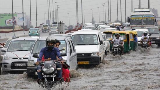
“A part of the monsoon trough is between Meerut and Delhi. This is causing rainfall over Delhi. There will be patchy rain over Delhi NCR (national capital region) and east- central India for 1-2 days, but the trough will again move northward around August 20,” said Mahesh Palawat, vice-president, climate and meteorology at Skymet Weather Services, a private forecaster. “Thereafter, we can expect heavy rain over the northern states of Himachal Pradesh and Uttarakhand again.”
Also Read: Why hill states of Himachal Pradesh, Uttarakhand are witnessing intense rainfall
{{/usCountry}}Also Read: Why hill states of Himachal Pradesh, Uttarakhand are witnessing intense rainfall
{{/usCountry}}A cyclonic circulation is lying over south-west Bangladesh and its neighbourhood and a western disturbance is impacting the western Himalayas, the weather office said. As a result, isolated but heavy rainfall is likely to continue over Himachal Pradesh in the next two days and over Uttarakhand and northeast India in the next 4-5 days, it warned.
“The current monsoon break spell is one of the most prolonged spells on record, already 10 days, likely to be 2-3 days more. The longest consecutive break spell was 18 July-3 August in 1972, a deficient year. In July 2002, 24 days were break days,” tweeted M Rajeevan, former secretary, ministry of earth sciences.
There is a likelihood of a gradual increase in rainfall over east and adjoining central India from Wednesday, the weather bureau said. Subdued rainfall is likely to continue over the rest of the country in the next 4-5 days, it said.
There is a 4% rainfall deficit over the country since June 1, with 10% deficit over southern peninsula; 18% deficit over east and northeast India; 13% excess over northwest India and average rainfall over central India.
The northward movement of the monsoon trough, and its interaction with a weak western disturbance, is responsible for the heavy rains in Himachal Pradesh and Uttarakhand that resulted in the deaths of several people in landslides, building collapses and damage to roads and other infrastructure on Monday.
The monsoon has entered a weak phase and there would be subdued rainfall over the plains because the trough was moving northward from its normal position, passing mostly over the Indo-Gangetic plains up to the Bay of Bengal, HT reported earlier.