Even as cannabis seizure in Odisha touches a record high with police alone seizing more than 1,100 quintal this year, the state government is now planning to use high-resolution satellite imagery and artificial intelligence to auto detect the massive cannabis plantation for destruction.
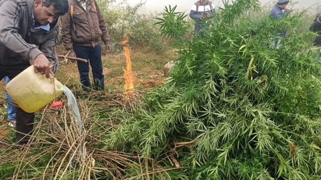
On Saturday, Odisha police seized a record 13 quintals of ganja worth ₹2 crore from two different places in Koraput district. The seizure made from an under-construction house at Hanumal village under the Machakund police station and a mini truck at Debata Chhak under the Padua police station of Koraput was the highest ever single-day catch. Other agencies like the Department of Revenue Intelligence (DRI), state excise as well as Narcotics Control Bureau (NCB) have also tasted success this year.
Cannabis means the flowering or fruiting tops of the cannabis plant (excluding the seeds and leaves when not accompanied by the tops) as well as charas, whether crude or purified, obtained from the cannabis plant and also includes concentrated preparation and resin known as hashish oil or liquid hashish. On average, 1,500 hemp plants can be grown in an acre. Upon harvesting, each hemp plant produces at least 500 gm of ganja. Locally, the ganja is sold at about 2,000 per kg. Odisha is one of the leading cannabis producing states in India.
Now flush with success of rising seizures, Odisha is planning to use remote-sensing technology, machine-learning algorithm and artificial intelligence to destroy large swathes of cannabis plantations in Malkangiri, Sambalpur, Deogarh, Kandhamal, Boudh, Rayagada, Gajapati, Angul and Nayagarh districts. Though more than four crore hemp plants, whose value is estimated at approximately ₹34,000 crore, have been destroyed in the past five years, the plantation is still widespread in those districts.
{{/usCountry}}Now flush with success of rising seizures, Odisha is planning to use remote-sensing technology, machine-learning algorithm and artificial intelligence to destroy large swathes of cannabis plantations in Malkangiri, Sambalpur, Deogarh, Kandhamal, Boudh, Rayagada, Gajapati, Angul and Nayagarh districts. Though more than four crore hemp plants, whose value is estimated at approximately ₹34,000 crore, have been destroyed in the past five years, the plantation is still widespread in those districts.
{{/usCountry}}“In the initial phase, the excise and police department officials will create a master record for all the cannabis plantation sites in Odisha by geo-tagging and geo-fencing. Based on those parameters, machine learning algorithms will be trained to identify cannabis plantations from high-resolution satellite imagery. Satellite images will be processed for radiometric, atmospheric, and geometric rectification, and will be used for the classification of cannabis,” said excise commissioner Anjan Kumar Manik.
As cannabis plantation activities start from October onwards, officials said high spatial and temporal resolution satellite images and advanced algorithms for image processing and spatial modelling would be able to produce reliable geographic information for law enforcement agencies.
Officials said use of high-resolution satellite imageries at regular intervals and machine learning algorithms would auto detect the cannabis plantation and help raise alerts for the authorities through a mobile application. The satellite data would help the authorities view the map of the whole state and administrative boundaries, marked with illegal plantation sites.
Apart from using satellite imagery, the government is also planning to start a citizen reporting module in which people can take the images and videos of any illegal plantation and report through the app.