There is likely to be light rain and thunderstorms in several parts of the western Himalayan region and adjoining northwest India for the next 3-4 days, according to the India Meteorological Department (IMD).
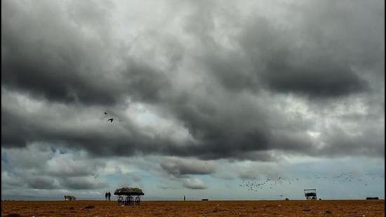
Two consecutive western disturbances (WDs) which were affecting the western Himalayan region have now weakened. Their impact,in combination with strong easterly winds, is likely to cause isolated thunderstorms over the region.
Rain or thundershowers occurred at some places over northwest India except east Uttar Pradesh where it was dry. Thunderstorms also occurred at isolated places over Jammu and Kashmir, Himachal Pradesh, Uttarakhand, Uttar Pradesh and Rajasthan on Saturday and Sunday. Hailstorm occurred at isolated places over Uttarakhand (Mussoorie) and dust storms occurred at some places over west Rajasthan.
“We are not expecting heat wave or very high temperatures over northwest India during the next 4-5 days. This is because of strong easterly winds which will cause isolated thunderstorm activity and the sky will remain overcast in many areas. Intense thunderstorm activity is expected in east, northeast and peninsular India during the next few days,” explained RK Jenamani, senior scientist, national weather forecasting centre.
A cyclonic circulation is lying over northwest Madhya Pradesh and neighbourhood and a trough (line of low pressure) is running from the circulation to Manipur. A trough in westerlies is also likely to persist over east India during the next 4-5 days.
{{/usCountry}}A cyclonic circulation is lying over northwest Madhya Pradesh and neighbourhood and a trough (line of low pressure) is running from the circulation to Manipur. A trough in westerlies is also likely to persist over east India during the next 4-5 days.
{{/usCountry}}Also Read | Severe weather warning for Maharashtra, heavy rain likely in areas bordering Karnataka
Under its influence, fairly widespread rainfall or thunderstorm activity is likely over sub Himalayan West Bengal, Sikkim, Assam and Meghalaya and scattered to fairly widespread rainfall over rest of east and northeast India during the next five days. Heavy rainfall is also likely over sub Himalayan West Bengal, Sikkim, Assam and Meghalaya during May 2 to 5; over Gangetic West Bengal from May 3 to 5 and over Odisha and Arunachal Pradesh on May 4. Intense thunderstorm activity accompanied with strong gusty winds is also likely over most parts of this region.
Under the influence of a cyclonic circulation over south Tamil Nadu and neighbourhood and a north-south trough or wind discontinuity over south Peninsula at lower levels, light/moderate scattered to fairly widespread rain or thunder is very likely over Kerala, Mahe, Lakshadweep and Karnataka; and isolated rain or thundershower over rest of south Peninsular India during the next five days.
No heat wave is likely over any part of the country during the next five days. Due to high swell waves, sea conditions are likely to be rough along and off the west coast Andaman & Nicobar Islands and along and off the coastal areas of south Tamil Nadu, Kerala, Karnataka, Lakshadweep on May 2. Fishermen are advised to be cautious while venturing into these areas.