Ahmedabad: The researchers at the Indian Institute of Technology (IIT) Gandhinagar have found that partial flood protection measures create inequality by protecting some neighborhoods while leaving others with worse flooding. The team developed tools to assess how protective infrastructure redistributes flood damage and deepens inequality in cities.
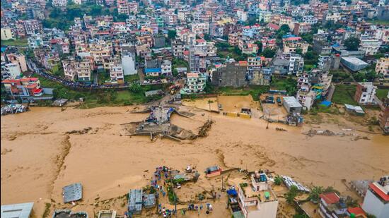
The study titled ‘Partial flood defenses shift risks and amplify inequality in a core–periphery city’ and published in leading journal Nature Cities on August 15, examines how levees and embankments affect flood risk across city parts.
Flooding is among the most devastating of natural hazards, causing around US$41.1 billion in annual economic losses and affecting 74.6 million people worldwide between 2003 and 2022. These impacts are expected to increase further as populations expand into floodplains, economic activities intensify and climate change drives more extreme flood events, as per the study.
Using Surat as a case-study, the researchers showed how partial flood defences shift risk toward vulnerable communities, raising questions about urban planning and equity.
“Adaptation must consider who is protected and who remains exposed, not just total risk reduction. Flood resilience is about ethics, not just about engineering. If our solutions protect some but leave others worse off, we haven’t solved the problem; we’ve just reshaped it. This study shows that we can do better, and now we know how,” said Udit Bhatia, Associate Professor at IITGN’s Department of Civil Engineering and the principal investigator of the study.
Cities worldwide use partial embankment systems and levees against flooding, from Spain to India, the study stated while noting that these structures hold back water and shield urban cores but redirect waters to city edges and informal settlements.
{{/usCountry}}Cities worldwide use partial embankment systems and levees against flooding, from Spain to India, the study stated while noting that these structures hold back water and shield urban cores but redirect waters to city edges and informal settlements.
{{/usCountry}}“In many cities of the Global South, peripheral areas house informal settlements, agricultural workers, and artisanal communities with limited access to infrastructure or disaster support,” said Bhatia.
The study uses Surat as a case study to generate what-if scenarios, a city on Gujarat’s Tapi River that has suffered repeated floods, including a major one in 2006. The researchers used a hydrodynamic model built with river records, city data, and 49 years of Ukai Reservoir discharges to simulate a 100-year flood with and without partial levees. They combined this with land-use damage estimates updated to 2022 replacement costs and ward-level demographic data to assess how losses change.
The results showed that partial levees reduced damages by ₹31.24 billion (US$380 million) in the city’s urban wards and ₹10.34 billion (US$125 million) in surrounding villages. At the same time, damages became more uneven. The researchers measured this using the Gini index, which ranges from 0 (losses evenly spread) to 1 (losses concentrated in one place). In Surat, the Gini for flood damages increased from 0.55 to 0.66 after levees, and the Gini for population exposure rose from 0.31 to 0.39, meaning fewer neighborhoods bore a greater share of the impact.
Ashish S. Kumar, the lead author and a PhD scholar in IITGN’s Department of Civil Engineering, said their approach looked beyond standard flood maps. “City planners need to know where water goes, how fast it arrives, how long it stays, and which communities are hit hardest,” he explained.
The analysis showed that neighborhoods close to the river gained up to 12 extra hours before flooding, while some downstream areas flooded up to seven hours earlier. Of Surat’s 284 neighborhoods, 119 experienced deeper floods and 134 saw less. In exposed areas, floodwaters rose by up to 2.38 meters, while protected areas saw water levels drop by as much as 10.13 meters.
“While core areas remained dry longer, downstream and peripheral wards, which are often less affluent and less protected, flooded earlier and more severely,” said Kumar, who is also the recipient of the Prime Minister Research Fellowship.
Flood volumes declined overall, with reductions of 28.51 million cubic meters in the city and 37.42 million in the suburbs. Expected annual savings were estimated at ₹2.02 billion in the core city and ₹1.44 billion in suburbs. But some downstream neighborhoods could still face additional damages of up to ₹600 million (US$7.3 million) over the next 50 years. These impacts fell most heavily on wards with larger shares of marginal workers, showing that economic vulnerability and residual flood risk overlap.
The authors describe this as a core–periphery dynamic, where central, economically important wards are protected while peripheral or rural zones remain exposed. They point out that similar patterns are seen elsewhere, such as in Valencia in 2024 when suburban areas were flooded while the city centre was shielded, and in cities like Chennai and Kinshasa where partial defences protect urban cores at the expense of the edges.
Co-author Rajarshi Majumder of the University of Burdwan noted that the worst-hit neighborhoods in Surat also had more precarious workers. Vivek Kapadia, who has worked on Gujarat’s water projects, said that choosing which areas to protect is as important as the engineering of the levees themselves.
The researchers conclude that levees remain necessary but should be combined with early warning systems, wetland and mangrove restoration, flood zoning, bypass channels, and reinvestment of tax revenues from protected zones into unprotected ones.
“Cities in India face tough choices with limited budgets,” Bhatia said. “But with the right tools, data, and intent, decisions can be better balanced.”