
 E-Paper



Snow in hills, rain in plains as western disturbance sweeps north India
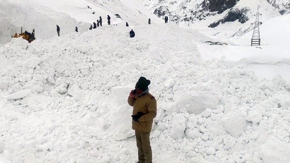
A western disturbance has blanketed the higher reaches of Himachal Pradesh and Jammu and Kashmir with snow, while bringing rain to the plains, including Delhi.

 Prefer HTon Google


The higher reaches of Himachal Pradesh and Jammu and Kashmir on Saturday witnessed fresh snowfall as a spell of wet weather gripped north India, bringing rainfall to parts of Delhi, Punjab, Haryana and Rajasthan.
Rains and hailstorms have continued to lash the northern states intermittently this week, with wheat growers in Punjab, Haryana and Rajasthan staring at major losses due to crop damage.
The national capital, meanwhile, witnessed rain during the night between Friday and Saturday in isolated areas. However, the maximum temperature in the city dropped due to persistent cloudy conditions throughout the day.
In Jammu and Kashmir, the snowfall also led to the closure of many important inter-district roads, officials said.
ALSO READ | Chandigarh: Expect hail, thunderstorm today
The Met Office warned of brief but intense heavy showers in isolated parts, which may lead to flash floods and landslides at a few vulnerable places and waterlogging in a few low-lying areas.
Sadhna Top and other higher reaches in Kupwara, Mughal Road in Shopian, Margan Top connecting Anantnag with Kishtwar, and Razdan Top, Gurez, and Tulail in Bandipora district, received fresh overnight snowfall.
The Affarwat mountain in Gulmarg tourist resort, the Sonamarg-Zojila axis, and some other hilly areas of the valley also received snowfall.
The plains of the valley, including the summer capital Srinagar, received rains, they added.
The wet weather brought down the day temperature across the valley as people had to layer up to battle the fresh cold.
ALSO READ | Dust, heat and rain: Delhi sees a day of multiple weather phenomena
Similarly, both maximum and minimum temperatures decreased in Himachal Pradesh, with light to moderate rain and snowfall observed in several areas.
The Shimla Meteorological Office has issued an orange alert for hailstorms, thunderstorms, lightning, and gusty winds with speeds of 40 to 50 kmph in the Chamba, Kangra, Kullu, Mandi, and Shimla districts on Tuesday and Wednesday.
In the higher reaches of Lahaul and Spiti and Kullu, fresh snowfall was witnessed over the past 24 hours since Friday evening. The weather department also predicted a wet spell in the state till April 10.
In the national capital, the minimum temperature rose to 20.7 degrees Celsius, which is 1.9 degrees above normal and 1.5 degrees higher than the previous day. In contrast, the maximum temperature reached 32 degrees Celsius, two degrees below normal and one degree lower than the day before.
Mahesh Palawat, vice president at Skymet, said, "This is due to the presence of a cloud cover, as a result of which lesser heat penetrates during the day and lesser heat escapes from the earth's surface at night."
Additionally, the air quality in Delhi showed significant improvement due to fresh showers and gusty winds the day before. The 24-hour average air quality index (AQI) was reported at 137 (moderate) at 4 pm on Saturday, compared to an AQI of 266 (poor) recorded at the same time on Friday, according to Central Pollution Control Board (CPCB) data.
According to CPCB standards, an AQI of 0-50 is considered 'good', 51-100 'satisfactory', 101-200 'moderate', 201-300 'poor', 301-400 'very poor', and 401-500 'severe'.
ALSO READ | IMD Orange alert issued for rain, thunderstorm, lightning in Delhi
In Punjab, the average maximum temperature dropped by 0.7 degree Celsius compared to a day before, staying 2.6 degees below normal, while in Haryana, it saw a fall of 0.9 degree and stayed 1.8 degrees Celsius below normal.
Rainfall was recorded in Pathankot, Rupnagar, Amritsar, Fazilka, Ferozepur in Punjab, as well as Haryana's Mahendragarh and Yamunanagar.
Parts of Rajasthan recorded rainfall and gusty winds over the past 24 hours due to a cyclonic circulation with more thunderstorms and hail activity forecasted for the region in the coming days, the IMD said on Saturday.
"A new and strong western disturbance is likely to become active over parts of Jodhpur and Bikaner divisions from the afternoon of April 6, leading to a high possibility of thunderstorm and rainfall activity in some areas," the IMD said.
The impact of the cyclone is expected to peak on April 7. "Under its activity, several parts of Jodhpur, Bikaner, Ajmer, Jaipur, Bharatpur and Kota divisions are likely to experience strong thunderstorms, gusty winds of 50-60 kmph, moderate to heavy rainfall and isolated hailstorms," it said.
"Farmers are advised to cover harvested crops and grains kept in open areas or shift them to safe storage to prevent damage due to rain and hail," the weather office said.
Former Rajasthan chief minister Ashok Gehlot demanded immediate financial assistance for farmers affected by unseasonal rain and hailstorms in parts of the state, saying the damage has caused a crisis for farmers.
"In some parts of the state, unseasonal rain and hailstorms have brought disaster upon farmers. Wheat and isabgol crops have been damaged in Bikaner division, while in Nagaur, crops like isabgol, cumin, wheat and fennel have suffered heavy losses," he said.
The IMD on Friday said temperatures are likely to remain below normal or near normal over most parts of the country in the next few days.
In March, eight western disturbances impacted the country, against the normal of five or six, it said.


