
 E-Paper



Unusual atmospheric patterns behind downpour in some parts, scanty rain in others, say experts
The patchy rains were due to an unusual pattern of a low-pressure area over Odisha and northern Andhra Pradesh persisting for over a week, and the monsoon trough remaining south of its usual position through the past two weeks.

 Prefer HTon Google


Unusual atmospheric patterns in the peak monsoon month of July has led to heavy showers in central and western India, but scanty rainfall over the Gangetic plains and northwest India, which is crucial for a healthy farm output from the summer cropping season. The situation is expected to change only after Tuesday.
The patchy rains were due to an unusual pattern of a low-pressure area over Odisha and northern Andhra Pradesh persisting for over a week, and the monsoon trough remaining south of its usual position through the past two weeks. Another unusual feature in the form of a depression developed on Saturday over northeast Arabian Sea off the Saurashtra coast, the weather office said.
The depression over the Arabian Sea is expected to cause heavy rain and squally weather over parts of Gujarat on Saturday. The system may also help pull the moisture away from the west coast, reducing rainfall marginally over central and west India. The depression is likely to move gradually north-northwestwards along and off the Saurashtra and Kutch coasts and adjoining northeast Arabian Sea during the next 24 hours. Thereafter, it is likely to move nearly westwards towards the Oman coast across northwest Arabian Sea in the next 48 hours.
Also Read: Widespread spell of rain brings Delhi some relief from sticky heat
There is a 46% rainfall deficiency over Gangetic West Bengal; 49% over Jharkhand; 44% over Bihar; 69% over eastern Uttar Pradesh and 59% over western Uttar Pradesh since June 1. But there is 81% excess rainfall over Marathwada; 112% excess over Saurashtra and Kutch; 64% excess over Gujarat; 40% excess over western Madhya Pradesh; and 125% excess over Telangana. Overall, there is 13% excess rainfall over the country.
“This deficit in rainfall over the Gangetic plains states is mainly the result of one low pressure area that formed over Odisha persisting for over a week, causing widespread and heavy rains over central India,” explained M Mohapatra, director general, India Meteorological Department. “The monsoon trough has also remained south of its normal position since the beginning of July.”
“This situation will change with the monsoon trough expected to shift gradually from July 17,” he added. “But heavy rains will begin over Uttar Pradesh, Bihar and West Bengal only after July 19 (Tuesday).”
Most of the northern Gangetic plains have been dry, and sowing has been impacted, while many districts have reported washing out of sown crops over central India, said said Mahesh Palawat, vice president of climate change and meteorology at Skymet Weather Services, a private forecaster.
“There have been only patchy rains over northwest India, including Punjab and Haryana, and no rain over eastern region. When the monsoon trough shifts, we can expect extremely heavy rain over Himalayan foothills for a day or two around July 18 and then heavy and widespread rains over the Indo-Gangetic Plains region,” he said. “That may bring relief, but it depends on the intensity of rain and the areas covered.”
The depression over Arabian Sea will pull the moisture towards itself, which may lead to a slight weakening of the monsoon in the next couple of days, according to Ananda Kumar Das, in-charge of the weather bureau’s cyclone monitoring division.
An offshore trough at sea level is also running from Gujarat coast to Maharashtra. Under the influence of all these weather systems, moderate rainfall, thunderstorm and lightning is likely to continue over Chhattisgarh, Madhya Pradesh, Odisha, Konkan, Goa, Kerala, Mahe, Karnataka and Lakshadweep during the next five days.
Widespread and moderate rainfall with isolated thunderstorm or lightning is likely over Jammu and Kashmir, Himachal Pradesh and Uttarakhand in the next three days, followed by fairly widespread rainfall on July 19 and 20, the Met department predicted.
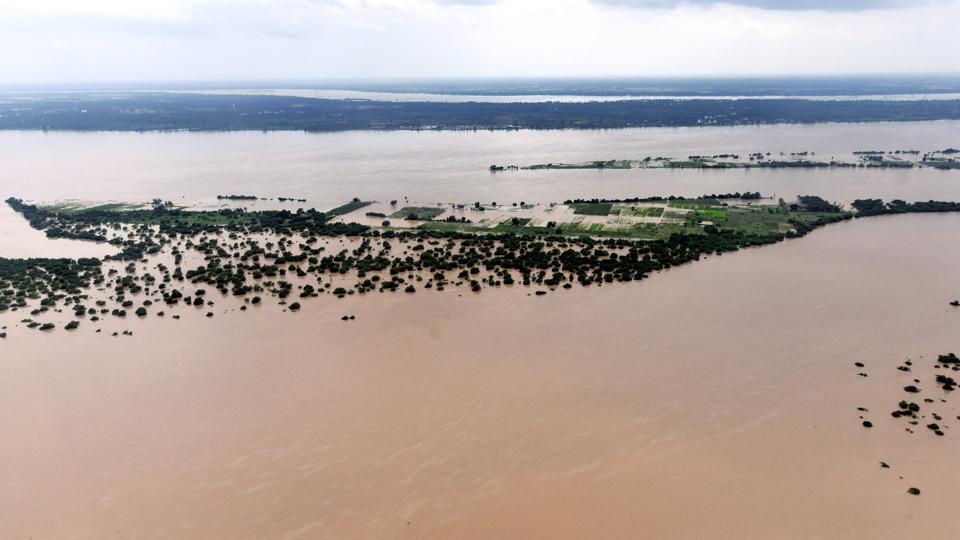
“Intense rainfall in Telangana last week resulted in heavy flooding leading to crop losses. Farmers who have shown the crops after earlier rains suffered losses. Vegetable crops also suffered losses as they were just ready to harvest,” said GV Ramanjaneyulu, executive director at the Centre for Sustainable Agriculture in Hyderabad.
“The larger question is the preparedness of government for such weather variations and disasters. a. In Telangana significant area shifted to paddy cultivation after the state govt encouraged paddy production. The land compaction has increased due to frequent puddling and high use of chemical fertilisers. As a result and flooding is becoming serious problem. b. Focus is only on irrigation and not on drainage and this will further increase the problems in years to come. c. State is not implementing any crop insurance scheme and not taking timely action for compensations in case of disasters. Both increase vulnerability of farmers in a situation of increasing risk,” he added.



