Heavy rain lashed several parts of Uttarakhand in the past 24 hours, triggering landslides and boulder falls that disrupted road connectivity across the state, while rising water levels in several rivers crossed warning thresholds, prompting authorities to step up monitoring and issue alerts to vulnerable settlements.
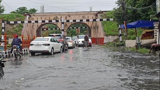
According to India Meteorological Department (IMD) Uttarakhand recorded an overall rainfall surplus of 13% in 24 hours till 8.30am Saturday, receiving 12.1mm of rain against the normal 10.7mm for the day.
The rainfall distribution remained highly uneven. Chamoli recorded a 382% surplus after receiving 22.2mm, while Bageshwar received 27.8mm, 292% above normal. Almora received 17.6mm, 148% above normal, and Pithoragarh recorded 24.5mm, a 93% surplus.
The IMD’s Dehradun centre has issued a yellow alert for September 6 to 9, forecasting light to moderate rain or thundershowers at many places across the state. Isolated heavy rainfall is expected in parts of Dehradun, Haridwar, Bageshwar, Nainital, Pauri and Chamoli, with thunderstorms and lightning also likely.
As many as 136 roads were reported closed across the state because of landslides and boulder falls, according to the latest district-wise assessment. The disruptions were reported from both the hill districts and the foothill areas, with Chamoli, Pauri and Pithoragarh among the worst affected.
Also Read:Delhi weather LIVE Update: IMD issues red alert in Delhi as heavy rain, thunderstorms lash NCR
{{/usCountry}}Also Read:Delhi weather LIVE Update: IMD issues red alert in Delhi as heavy rain, thunderstorms lash NCR
{{/usCountry}}Chamoli reported the highest number of road closures at 25, followed by Pauri with 22 and Pithoragarh with 18. Nainital reported 16 closed roads, while Almora and Tehri recorded 11 each. Dehradun had 10 road closures, followed by Uttarkashi with eight, Rudraprayag with seven, Bageshwar with six and Haridwar with one.
The continuing rain also pushed river levels up at several monitoring stations, raising concerns in areas located along riverbanks and downstream of dams and barrages.
According to data from the Central Water Commission (CWC), the State Emergency Operation Centre and district disaster management authorities, several rivers crossed their designated warning levels on Saturday, prompting heightened vigilance in Pithoragarh, Nainital and Haridwar, among other areas.
In Pithoragarh, three major rivers, the Dhauliganga, Gauri Ganga and Kali, crossed their respective warning thresholds.
The Dhauliganga rose to 1,550.63 metres at 8am, exceeding its warning level of 1,550.10 metres. The Gauri Ganga at Bangapani reached 987.42 metres at 1pm, crossing its warning level of 987.25 metres and moving closer to the danger mark of 988.25 metres.
The Kali River at Dharchula touched 889.50 metres at 7.30am and 889.40 metres at 8am, crossing its warning threshold of 889 metres. Its level was less than half a metre below the danger mark of 890 metres.
The Pithoragarh administration sounded an alert in villages and settlements along the Kali river in the Jhulaghat region following information received from officials in Nepal about a possible obstruction on the Chamelia River.
Bhupendra Singh Mahar, district disaster management officer, Pithoragarh, said officials received information from the chief district officers of Baitadi and Dharchula districts of Nepal about the situation.
“The Pithoragarh administration was given information by the chief district officers of Baitadi and Dharchula districts of Nepal. Though the Kali River is flowing normally ahead of the Chamelia waterfalls, an alert has been sounded near villages along the Kali on the Indian side. The SSB and ITBP have also been requested to remain alert,” he said.
Authorities advised people living close to the river to remain vigilant and follow instructions issued by the district administration.
In Nainital district, the Kosi River crossed its warning threshold after its water level rose to 996.28 metres, exceeding the warning mark of 996 metres.
The river was flowing 0.72 metres below its danger level of 997 metres. The rise prompted local disaster management and revenue officials to increase monitoring of downstream settlements and vulnerable areas along the river.
Residents living near riverbanks and commuters have been advised to exercise caution, maintain a safe distance from the water and monitor official updates as water continues to flow into the river from upper catchments.
In Haridwar, the Banganga River also crossed its warning level. Its water level reached 230.96 metres, against a warning threshold of 230 metres, bringing it close to the danger mark of 231 metres.
In Rudraprayag, water levels in the Alaknanda and Mandakini rivers also rose following local rainfall.
The Alaknanda stood at 625.45 metres at 8am, against a warning level of 626 metres and danger level of 627 metres. The Mandakini rose to 624.34 metres, with its warning level at 625 metres and danger level at 626 metres.
A high alert was sounded along the Mandakini downstream of the Kund Barrage after authorities scheduled a controlled release of water from all gates of the barrage under the Singoli-Bhatwari Hydroelectric Project between 2pm and 3pm.
The project authorities warned residents and villagers living near the river to maintain a safe distance from the riverbanks. People were also advised not to allow livestock to graze near the river and were directed to suspend riverbed extraction, construction and transportation activities in the river corridor during the release.
The rising inflows also led to increased releases from several barrages and dams.
In Haridwar, the Bhimgoda Barrage discharged 1,13,450 cusecs at a water level of 292.35 metres. Upstream, the Veerbhadra Barrage in Rishikesh released 96,338.50 cusecs at 334.10 metres.
In Dehradun district, the Dakpathar Barrage discharged 16,160 cusecs, while the Asan Barrage released 9,800 cusecs. The Vyasi Dam at Juddo recorded an outflow of 5,643.90 cusecs.
Near Vikasnagar, the Ichari Dam was operating close to capacity at 644.70 metres, only five centimetres below its danger level of 644.75 metres, while discharging 9,714.63 cusecs.
At Tehri Dam, the lake level was between 826.15 metres and 828.25 metres at 8am, against a danger level of 830 metres. The dam was discharging 553 cubic metres per second, equivalent to about 19,355 cusecs.
In Champawat, discharge from the Sharda Barrage had risen during the morning but subsequently declined to around 1,35,000 cusecs.
Manish Kumar, district magistrate, Champawat, said the situation was under control as the Sharda River level had started receding.
“With the water level of the Sharda River receding, the situation is under control. Directions have been given to all officials to ensure close monitoring and respond to any emergency, especially during soil erosion and waterlogging situations in sensitive villages, including Gendakhali on the riverbank,” he said.